Little snoozey
TunaCan - Wingfoiling |
Wednesday October 23, 2024 3:03 PM |
| Spot | Ross Bay |
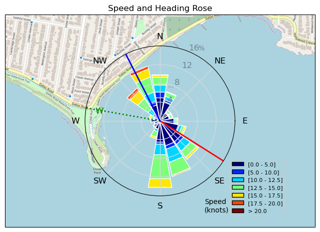
| Conditions | W 10-20, 1 |
| TOW | 1.0 hours |
| Details | Parked behind RuppDog and he got me all amped up, as it looked windy. I decided on the 3.5 and a borrowed the surf 205 tail to go with the MA1225. Wind dropped off and the 3.5 was suddenly way to small. Switched up to the 5m (with run over valve in place) and headed back out nicely powered when the gusts came. Swell seemed few and far between for me, and i wasn't feeling the most energized, so kind of cruised around. Found a decent kelp patch to jump over a couple times which was upped the entertainment levels, felt like I got a really good Raley over it which was cool. Came in and tried to see how long i could sail around on the inside in ultra light wind. Few tacks back and forth going from gust to gust. [from Session Log on Wednesday October 23, 2024] |
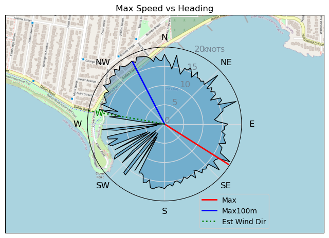
Speed (3s average)
| Speed | knots | km/h |
|---|---|---|
| Avg overall | 7.2 | 13.4 |
| Avg in motion | 10.4 | 19.3 |
| Max | 19.6 | 36.2 |
| Max 100m | 18.0 | 33.4 |
| Max 250m | 17.3 | 32.1 |
| Max 500m | 15.4 | 28.5 |
| Max 2s | 19.5 | 36.2 |
| Max 10s | 18.2 | 33.6 |
| Max Alpha (500/50m) | 15.1 | 27.9 |
| Avg Foiling | 12.8 | 23.7 |
Times and Duration
| Start | Wed Oct 23, 3:03 PM |
| End | Wed Oct 23, 4:52 PM |
| Duration | 01:48:52 |
| In motion | 01:15:32 |
| Paused (< 3 km/h) | 00:29:30 |
| Foiling | 00:55:13 |
| Not Foiling (< 8 km/h) | 00:49:49 |
| Longest Foiling Segment | 00:08:18 (3.5 km) |
| Last Calculated | Wed Oct 23, 6:46 PM |
Track Information
| Distance | 24.3 km |
| # Trackpoints | 6279 |
| Avg Trackpoint distance | 3.9 m |
| Number of Turns | 97 |
| Foiling Turns (> 8 km/h) | 72 |
| Foiling Turn Percentage | 74% |


Category: Wingfoiling
5 weeks ago

Created 5 weeks ago
TunaCan |
Please register/login to download this track.
This track was downloaded 0 time(s). |
| 13 Swell beckons |
| 17 Clover week |
| 35 Double rainbowwww |
| 30 aCloverBalmyBombo |
| 28 Maytag day at IV 20241122 |
Please wait while loading suggestions..
Please wait while loading suggestions..
You must login to post comments.