Just the right amount of North
AJSpencer - Wingfoiling |
Monday July 22, 2024 5:53 PM |
| Spot | Pat Bay |
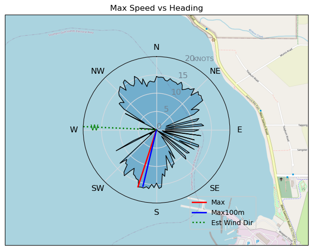
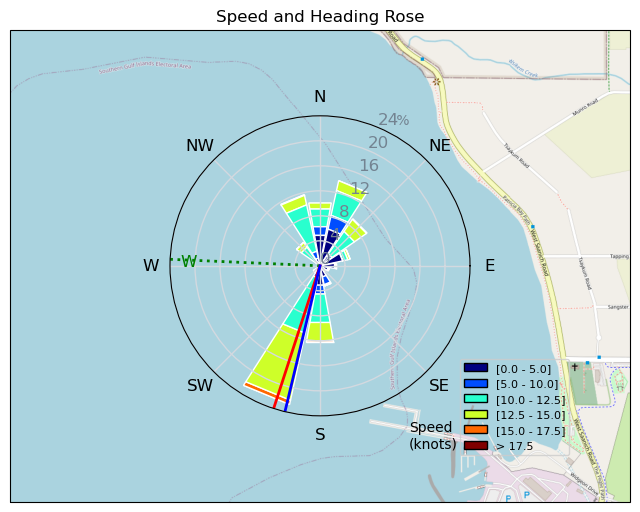
| Conditions | WNW 15-25, decent |
| TOW | 1.3 hours |
| Toys | 400 Axis Rear Performance |
| 860 Axis SP | |
| 105 Axis Mast | |
| 5.0 Duotone Slick | |
| 105 Quatro Wing Drifter | |
| Details | Great to be out after quite a few weeks. Nice to see wind in Pat Bay again..! ~15 mins OP on the 5m ~25 knots, then ~45 mins perfect with surprisingly decent waves from the WNW, just North enough to get some of that fetch towards Cow Bay. Fun S turns on port back into the bay and then long hitches up above the CG docks on Starboard and repeat. Then ~20 mins slog as it died <15knots. No complaints! Fun in the home bay. Hope everyone had a great time at RB. Miss seeing you all rip. [from Session Log on Monday July 22, 2024] |
Speed (3s average)
| Speed | knots | km/h |
|---|---|---|
| Avg overall | 6.0 | 11.2 |
| Avg in motion | 8.6 | 15.9 |
| Max | 16.4 | 30.3 |
| Max 100m | 16.0 | 29.7 |
| Max 250m | 15.0 | 27.7 |
| Max 500m | 13.6 | 25.2 |
| Max 2s | 16.3 | 30.3 |
| Max 10s | 16.0 | 29.7 |
| Max Alpha (500/50m) | 11.4 | 21.2 |
| Avg Foiling | 11.5 | 21.3 |
Times and Duration
| Start | Mon Jul 22, 5:53 PM |
| End | Mon Jul 22, 7:17 PM |
| Duration | 01:23:20 |
| In motion | 00:58:47 |
| Paused (< 3 km/h) | 00:24:31 |
| Foiling | 00:37:38 |
| Not Foiling (< 8 km/h) | 00:45:40 |
| Longest Foiling Segment | 00:04:25 (1.5 km) |
| Last Calculated | Mon Jul 22, 10:37 PM |
Track Information
| Distance | 15.5 km |
| # Trackpoints | 3056 |
| Avg Trackpoint distance | 5.1 m |
| Number of Turns | 22 |
| Foiling Turns (> 8 km/h) | 5 |
| Foiling Turn Percentage | 23% |


Category: Wingfoiling
5 months ago

Created 5 months ago
AJSpencer |
Please register/login to download this track.
This track was downloaded 0 time(s). |
Please wait while loading suggestions..
Please wait while loading suggestions..
You must login to post comments.