CC - August 8 - Wingfoil
Bobson - Wingfoiling |
Thursday August 08, 2024 12:20 PM |
| Spot | China Ck |
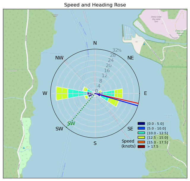
| Conditions | W 10-16, Flatter than that |
| TOW | 3.0 hours |
| Details | On the water at 12:20 in 8-10kts. Practice my Wing-schlog for 30 mins then wind picked up to 10-15kts. The 6.0m is rough on the hands trying to head upwind. The bad thing about not crashing as much is that my hands don't get a rest. Time for a harness I'm guessing. Pretty fun flat water paradise. There are some waves out n the channel or in the tide line but mostly flat so good for jibe practice and toe-side riding. I wore gloves today as my hands are painful and raw. 55kms on the Wing is tough trying to hold the handles gently. One of my fav things here at CC is sitting on the beach with an ice cold ( yes, got more ice today) Corona and some chips watching the sun go down and the last few wind lovers out on the water. BOBSON ALMOST OUT' still need to Windfoil today. [from Session Log on Thursday August 08, 2024] |
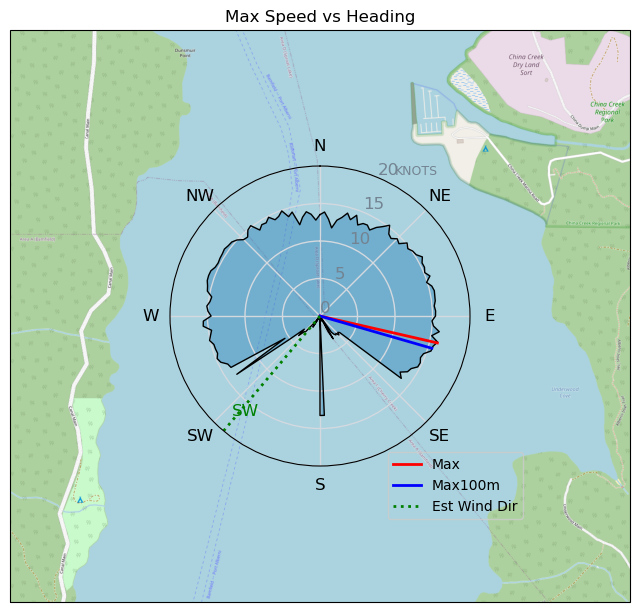
Speed (3s average)
| Speed | knots | km/h |
|---|---|---|
| Avg overall | 8.5 | 15.7 |
| Avg in motion | 10.2 | 18.9 |
| Max | 16.1 | 29.7 |
| Max 100m | 15.3 | 28.4 |
| Max 250m | 15.0 | 27.7 |
| Max 500m | 14.7 | 27.2 |
| Max 2s | 16.0 | 29.7 |
| Max 10s | 15.5 | 28.6 |
| Max Alpha (500/50m) | 13.4 | 24.9 |
| Avg Foiling | 12.3 | 22.8 |
Times and Duration
| Start | Thu Aug 08, 12:20 PM |
| End | Thu Aug 08, 3:48 PM |
| Duration | 03:27:54 |
| In motion | 02:53:14 |
| Paused (< 3 km/h) | 00:30:09 |
| Foiling | 02:13:48 |
| Not Foiling (< 8 km/h) | 01:09:35 |
| Longest Foiling Segment | 00:25:47 (10.2 km) |
| Last Calculated | Sun Aug 11, 3:27 PM |
Track Information
| Distance | 54.5 km |
| # Trackpoints | 11270 |
| Avg Trackpoint distance | 4.8 m |
| Number of Turns | 84 |
| Foiling Turns (> 8 km/h) | 62 |
| Foiling Turn Percentage | 74% |


Category: Wingfoiling
4 months ago

Created 4 months ago
Bobson |
Please register/login to download this track.
This track was downloaded 0 time(s). |
Please wait while loading suggestions..
Please wait while loading suggestions..
You must login to post comments.