Very light wind at Clover 20240815
davey_k - Kitesurfing |
Thursday August 15, 2024 4:11 PM |
| Spot | Clover Pt |
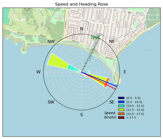
| Conditions | SW 13-17, flat for clover |
| TOW | 0.5 hours |
| Toys | 52cm Ocean Rodeo Shift Bar (Gen 3) |
| 14.5 Ocean Rodeo Flite (A-Series) | |
| 5'4" Ocean Rodeo Duke 3 | |
| Details | I was handed the torch by CB and went out in very light wind for a solo session. I made the best of it for 30 minutes or so but had to come in when it lulled. I felt decently powered on my runs to Finlayson Point and back but gybes and tack turns were hard in the light wind. I do wish that I had got more than 30 minutes since there doesn't seem to be any wind for the upcoming weekend, but I am grateful nonetheless for the light wind I was offered and for my fantastic Series A 14.5 Flite which is so floaty and well behaved. [from Session Log on Thursday August 15, 2024] |
Speed (3s average)
| Speed | knots | km/h |
|---|---|---|
| Avg overall | 8.8 | 16.2 |
| Avg in motion | 10.4 | 19.2 |
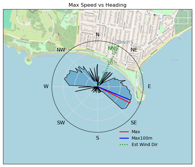
| Max | 15.8 | 29.3 |
| Max 100m | 15.3 | 28.4 |
| Max 250m | 15.0 | 27.8 |
| Max 500m | 14.7 | 27.2 |
| Max 2s | 15.7 | 29.0 |
| Max 10s | 15.4 | 28.5 |
| Max Alpha (500/50m) | 12.9 | 24.0 |
| Avg Planing | 12.2 | 22.7 |
Times and Duration
| Start | Thu Aug 15, 4:11 PM |
| End | Thu Aug 15, 4:51 PM |
| Duration | 00:40:02 |
| In motion | 00:33:51 |
| Paused (< 3 km/h) | 00:06:00 |
| Planing | 00:26:50 |
| Not Planing (< 8 km/h) | 00:13:01 |
| Longest Planing Segment | 00:04:38 (1.8 km) |
| Last Calculated | Thu Aug 15, 7:12 PM |
Track Information
| Distance | 10.8 km |
| # Trackpoints | 1842 |
| Avg Trackpoint distance | 5.9 m |
| Number of Turns | 14 |
| Planing Turns (> 8 km/h) | 6 |
| Planing Turn Percentage | 43% |


Category: Kitesurfing
4 months ago

Created 4 months ago
davey_k |
Please register/login to download this track.
This track was downloaded 0 time(s). |
Please wait while loading suggestions..
Please wait while loading suggestions..
You must login to post comments.