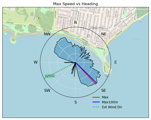
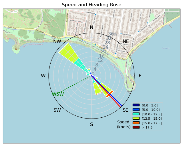
Light wind Canada Day Tiki session
davey_k - Kitesurfing |
Monday July 01, 2024 1:04 PM |
| Spot | Clover Pt |
| Conditions | SW 12-16, smooth, dark and cool |
| TOW | 1.0 hours |
| Toys | 52cm Ocean Rodeo Shift Bar (Gen 3) |
| 14.5 Ocean Rodeo Flite (A-Series) | |
| 230 Takoon Tiki | |
| Details | Brought out the light wind foil-alternative gear for a super light wind session. One kiter on a 12m was came in as I arrived and said it was a hard go with the 12m. So I pumped the 14.5 Aluula Flite and took the big Tiki dance floor. It was a perfect combination for the day. I got a launch from j_dog and headed out on the windward side. There were no white caps, no chop and no swell. Just wavelets. I had lots of power most of the time but a few lulls did happen but they were not so bad that I was worried about the kite falling. I tried some tacks and made a couple but with such light wind it was hard to have success. Up by Finlayson Point the wind was quite light and I stayed away after struggling there on a couple of gybes. Fun to share the water and stoke with j_dog. Beautiful day. [from Session Log on Monday July 01, 2024] |
Speed (3s average)
| Speed | knots | km/h |
|---|---|---|
| Avg overall | 9.2 | 17.0 |
| Avg in motion | 10.6 | 19.6 |
| Max | 16.8 | 31.2 |
| Max 100m | 16.3 | 30.2 |
| Max 250m | 14.8 | 27.5 |
| Max 500m | 14.4 | 26.6 |
| Max 2s | 16.8 | 31.1 |
| Max 10s | 16.5 | 30.5 |
| Max Alpha (500/50m) | 12.6 | 23.4 |
| Avg Planing | 11.7 | 21.7 |
Times and Duration
| Start | Mon Jul 01, 1:04 PM |
| End | Mon Jul 01, 2:13 PM |
| Duration | 01:09:03 |
| In motion | 01:00:00 |
| Paused (< 3 km/h) | 00:08:59 |
| Planing | 00:51:54 |
| Not Planing (< 8 km/h) | 00:17:05 |
| Longest Planing Segment | 00:04:22 (1.7 km) |
| Last Calculated | Mon Jul 01, 4:19 PM |
Track Information
| Distance | 19.6 km |
| # Trackpoints | 3374 |
| Avg Trackpoint distance | 5.8 m |
| Number of Turns | 41 |
| Planing Turns (> 8 km/h) | 19 |
| Planing Turn Percentage | 46% |


Category: Kitesurfing
2 days ago

Created 2 days ago
davey_k |
Please register/login to download this track.
This track was downloaded 0 time(s). |
| 11 RB only one kelp hit! |
| 21 RB starboard! |
| 19 RB super light gales |
| 17 CC - June 30 - Day 9 - Wingfoil |
| 14 CC - June 30 - Day 9 - Windfoil |
Please wait while loading suggestions..
Please wait while loading suggestions..
You must login to post comments.