NN - Day 6
Bobson - Windfoiling |
Wednesday May 24, 2023 10:54 AM |
| Spot | Nitinat Lk |
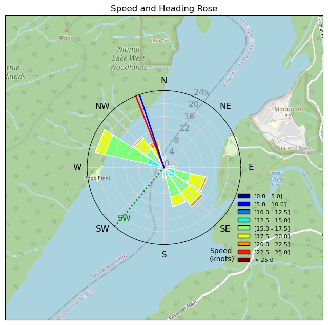
| Conditions | W 20-23, Wet |
| TOW | 3.5 hours |
| Toys | 1100 Starboard Front wing |
| 330 Starboard Stabilizer | |
| 255 Starboard Stabilizer | |
| 85cm Starboard Mast | |
| 95+ Starboard Fuse | |
| 1700 Starboard Super Cruiser | |
| 102 Classic Starboard Fuse | |
| 115+ Starboard Fuse | |
| 5.2 Sailworks Flyer | |
| 3.9 Sailworks Flyer | |
| 125 Starboard Freeride | |
| 150 Starboard Freeride | |
| Details | Started out at 11am in 20kts on the 5.2m and did 50kms. KC7-R showed up and we sailed and chatted the rest of the afternoon. I switched between the big board and 1100/255 and the small board and Super Cruiser 1700/330. Fell in 4 or 5 times, yuck! Could have done another 50kms but decided Corona's on the beach. It blew 15-20 till 7:30pm. Steak and potatoes for dinner and still lots of bugs! A few more peeps in the canpground now, maybe 10 all together. Foiled with Alberta- Mike who was killing it on his Wingfoil. KC7-R ripping on his new Goya windsurf board' and yes some people still windsurf. Weird! BOBSON OUT!! [from Sailing Log on Wednesday May 24, 2023] |
Speed (3s average)
| Speed | knots | km/h |
|---|---|---|
| Avg overall | 9.7 | 18.0 |
| Avg in motion | 16.1 | 29.8 |
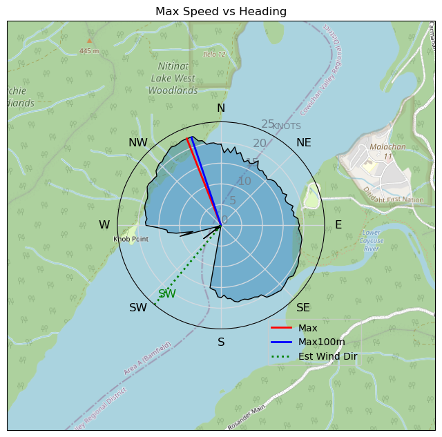
| Max | 22.5 | 41.7 |
| Max 100m | 22.4 | 41.4 |
| Max 250m | 22.2 | 41.0 |
| Max 500m | 21.8 | 40.4 |
| Max 2s | 22.5 | 41.7 |
| Max 10s | 22.3 | 41.4 |
| Max Alpha (500/50m) | 19.1 | 35.4 |
| Avg Foiling | 16.3 | 30.1 |
Times and Duration
| Start | Wed May 24, 10:54 AM |
| End | Wed May 24, 4:40 PM |
| Duration | 05:45:50 |
| In motion | 03:28:07 |
| Paused (< 3 km/h) | 02:16:18 |
| Foiling | 03:24:31 |
| Not Foiling (< 8 km/h) | 02:19:54 |
| Last Calculated | Sat May 27, 6:05 PM |
Track Information
| Distance | 103.5 km |
| # Trackpoints | 12747 |
| Avg Trackpoint distance | 8.1 m |
| Number of Turns | 141 |
| Foiling Turns (> 8 km/h) | 130 |
| Foiling Turn Percentage | 92% |


Category: Windfoiling
one year ago

Created one year ago
Bobson |
Please register/login to download this track.
This track was downloaded 0 time(s). |
| 26 241120 Willows |
| 32 Willows Bomb Session |
| 36 Shoot the Entrance |
| 26 CloverPartDeux |
| 17 Come back soon Bombo |
Please wait while loading suggestions..
Please wait while loading suggestions..
You must login to post comments.