RB - Ghost Town
Bobson - Windfoil |
Friday October 21, 2022 5:16 PM |
| Spot | Ross Bay |
| Conditions | SW 10-13, Flat for RB |
| TOW | 1.0 hours |
| Toys | 115+ Starboard Fuse |
| 1100 Starboard Front wing | |
| 85cm Starboard Mast | |
| 255 Starboard Stabilizer | |
| 6.0 Sailworks Flyer | |
| 125 Starboard Freeride | |
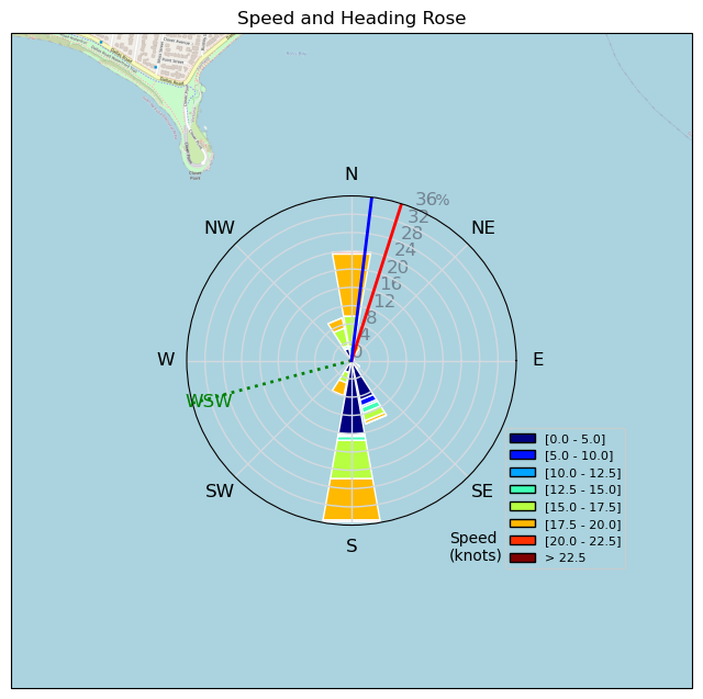
| Details | Arrived at just before 5pm to a ghost town at RB. Steady rain and what felt like chilly temps, maybe 10 degrees. Very light inside 5kts but more outside and West of Clover looked like solid 15kts. Rigged 6.0m Flyer and go-to 1100cm2 foil. Schlogged out for 10 mins around the Kelp to the wind and then had a great 45 mins in 10-13kts of wind. Wish I arrived earlier but work sucks so couldn't. No one around and not even much kelp and no debris so pretty clean foiling. Wind started to lighten and sky started to darken so played it safe and called it a day. Foiled right in to 200m of the beach which I feel was pretty good with maybe 5-7 kts inside. Felt like a Kook when I first went out almost forgetting how to pump and gybe. Feels like it's been awhile. Maybe more this weekend..?? BOBSON OUT!! [from Sailing Log on Friday October 21, 2022] |
Speed (3s average)
| Speed | knots | km/h |
|---|---|---|
| Avg overall | 12.5 | 23.1 |
| Avg in motion | 12.5 | 23.1 |
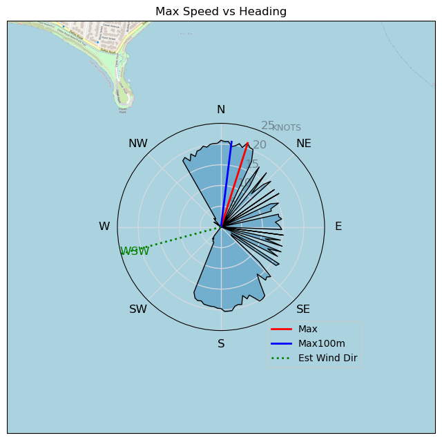
| Max | 21.2 | 39.3 |
| Max 100m | 20.2 | 37.5 |
| Max 250m | 19.7 | 36.5 |
| Max 500m | 19.4 | 36.0 |
| Max 2s | 20.9 | 38.7 |
| Max 10s | 20.2 | 37.5 |
| Max Alpha (500/50m) | 17.1 | 31.8 |
| Avg Foiling | 16.5 | 30.5 |
Times and Duration
| Start | Fri Oct 21, 5:16 PM |
| End | Fri Oct 21, 5:57 PM |
| Duration | 00:40:57 |
| In motion | 00:40:53 |
| Paused (< 3 km/h) | 00:00:01 |
| Foiling | 00:28:24 |
| Not Foiling (< 8 km/h) | 00:12:30 |
| Last Calculated | Sat Oct 22, 8:47 AM |
Track Information
| Distance | 15.8 km |
| # Trackpoints | 2457 |
| Avg Trackpoint distance | 6.4 m |
| Number of Turns | 10 |
| Foiling Turns (> 8 km/h) | 10 |
| Foiling Turn Percentage | 100% |


Category: Windfoiling
2 years ago

Created 2 years ago
Bobson |
Please register/login to download this track.
This track was downloaded 0 time(s). |
| 29 241120 Willows |
| 37 Willows Bomb Session |
| 37 Shoot the Entrance |
| 27 CloverPartDeux |
| 21 Come back soon Bombo |
Please wait while loading suggestions..
Please wait while loading suggestions..
You must login to post comments.