Boxing Day Sail
UnusuallyLargeRobin - Wingfoil |
Monday December 26, 2022 12:07 PM |
| Spot | Ross Bay |
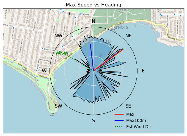
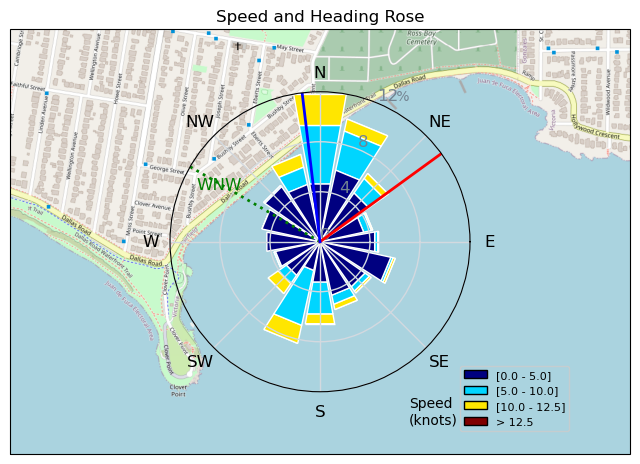
| Conditions | WNW 10-14, flattish |
| TOW | 0.5 hours |
| Toys | 1150/425p/crazyshort/90mast Axis Foil |
| 5.5 Duotone Unit | |
| 75 lt Fanatic Sky Wing 5'0 | |
| Details | After much waffling around (not eating waffles), finally headed out around 11 to look at the spots, Cattle nope, Willows nope, Ross Bay light but doable with Tuna Brett and Navy Grant rigging up. A bit of a float to the "wind" at the kelp line, little puff allowed me to stand and get flying. Was fun, short, easy and nice to get wet after about 2 weeks with no winging. Grant was heading in yelling it was too light, Tuna was working his way in, and I decided to milk the last few reaches near the point. Managed to fly back to just inside the kelp line, then watusi, then sit and wait, then give in and paddle back in to the beach. [from Sailing Log on Monday December 26, 2022] |
Speed (3s average)
| Speed | knots | km/h |
|---|---|---|
| Avg overall | 3.3 | 6.2 |
| Avg in motion | 7.1 | 13.2 |
| Max | 12.5 | 23.1 |
| Max 100m | 10.7 | 19.8 |
| Max 250m | 10.4 | 19.2 |
| Max 500m | 10.2 | 18.9 |
| Max 2s | 12.5 | 23.1 |
| Max 10s | 11.4 | 21.2 |
| Max Alpha (500/50m) | 10.0 | 18.5 |
| Avg Foiling | 9.2 | 17.1 |
Times and Duration
| Start | Mon Dec 26, 12:07 PM |
| End | Mon Dec 26, 1:01 PM |
| Duration | 00:54:14 |
| In motion | 00:25:26 |
| Paused (< 3 km/h) | 00:27:40 |
| Foiling | 00:15:12 |
| Not Foiling (< 8 km/h) | 00:37:54 |
| Last Calculated | Mon Dec 26, 2:13 PM |
Track Information
| Distance | 5.6 km |
| # Trackpoints | 1621 |
| Avg Trackpoint distance | 3.5 m |
| Number of Turns | 39 |
| Foiling Turns (> 8 km/h) | 11 |
| Foiling Turn Percentage | 28% |


Category: Wingfoiling
2 years ago

Created 2 years ago
UnusuallyLargeRobin |
Please register/login to download this track.
This track was downloaded 0 time(s). |
| 32 241120 Willows |
| 39 Willows Bomb Session |
| 38 Shoot the Entrance |
| 29 CloverPartDeux |
| 23 Come back soon Bombo |
Please wait while loading suggestions..
Please wait while loading suggestions..
You must login to post comments.