CrazyClover
UnusuallyLargeRobin - Wingfoil |
Sunday January 15, 2023 3:41 PM |
| Spot | Clover Pt |
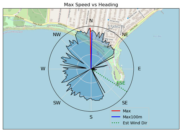
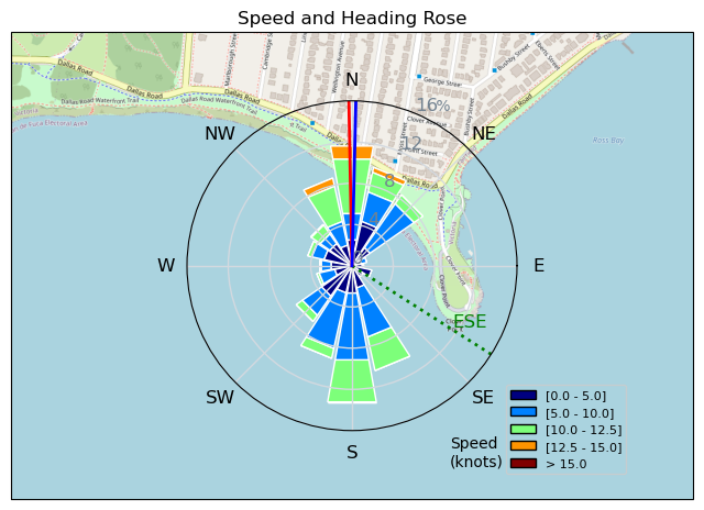
| Conditions | SE 28-35, 4-7' |
| TOW | 1.3 hours |
| Toys | S1000 (1310cm2) Axis Front Foil |
| 425 P Axis Rear Foil/Stab | |
| 90cm Axis Alu Mast | |
| Crazyshort (58.5cm) Axis Red Fuselage | |
| 187 lb / 85 kg Me Carbon-based Lifeform | |
| 4.0 Duotone Unit | |
| 75 lt Fanatic Sky Wing 5'0 | |
| Details | Yowzer!! That was fun! Big wind, huge swell. Had some of my biggest waves ever on wing, and a couple of really nice rides. Loads of fun with Winddoc, then Tweezer joined us. Despite there being tons of room, i still managed to almost collide/touch wings with Mark after a jibe (Starboard! :) ) It was really windy! Once again had to go in and move my foil back to give me some control (almost at the back of tracks!). Forgot to start the gps, so a shortened track. [from Sailing Log on Sunday January 15, 2023] |
Speed (3s average)
| Speed | knots | km/h |
|---|---|---|
| Avg overall | 6.7 | 12.4 |
| Avg in motion | 8.6 | 15.9 |
| Max | 14.3 | 26.4 |
| Max 100m | 12.8 | 23.8 |
| Max 250m | 11.7 | 21.6 |
| Max 500m | 11.1 | 20.5 |
| Max 2s | 14.3 | 26.4 |
| Max 10s | 12.9 | 23.8 |
| Max Alpha (500/50m) | 11.1 | 20.5 |
| Avg Foiling | 9.6 | 17.8 |
Times and Duration
| Start | Sun Jan 15, 3:41 PM |
| End | Sun Jan 15, 4:15 PM |
| Duration | 00:34:12 |
| In motion | 00:26:37 |
| Paused (< 3 km/h) | 00:07:11 |
| Foiling | 00:22:01 |
| Not Foiling (< 8 km/h) | 00:11:47 |
| Last Calculated | Mon Jan 16, 8:32 AM |
Track Information
| Distance | 7.1 km |
| # Trackpoints | 1229 |
| Avg Trackpoint distance | 5.7 m |
| Number of Turns | 42 |
| Foiling Turns (> 8 km/h) | 26 |
| Foiling Turn Percentage | 62% |


Category: Wingfoiling
2 years ago

Created 2 years ago
UnusuallyLargeRobin |
Please register/login to download this track.
This track was downloaded 0 time(s). |
| 32 241120 Willows |
| 39 Willows Bomb Session |
| 38 Shoot the Entrance |
| 29 CloverPartDeux |
| 23 Come back soon Bombo |
Please wait while loading suggestions..
Please wait while loading suggestions..
You must login to post comments.