Follow me?
tweezer - Wingfoil |
Saturday January 28, 2023 1:34 PM |
| Spot | Cattle Pt |
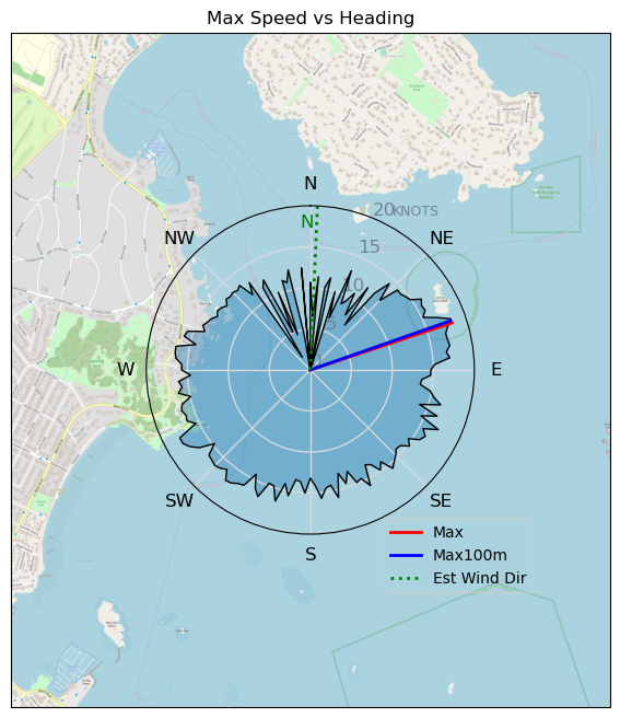
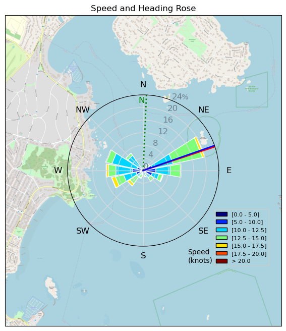
| Conditions | NE 15-20, Small chop |
| TOW | 1.8 hours |
| Toys | 325/62 Axis 325p rear |
| 90cm Axis mast | |
| 1038cm2 Axis ART 999 | |
| 60.3 Axis Crazy short fuse | |
| 5.2 Ensis Score | |
| 5'4" 90L Quatro Wing Drifter | |
| Details | Bobson, Sam, ULR already out at CP when I got there. MF4 was heading out on 6m windfoil. ULR came in to trade 5.5 for a 4m. But it dropped a little. Went with the 5.2m. Gusty with some lulls but never had to wait long for the next puff. Lots of dinghys out. Dog, Fraser, RichardM, Wingdoc, Gus all jumped in. Dragged ULR out to 10mile Pt to see if the swells were any good. Tons of current, but it was all going downwind. It felt like foiling in a river. The turbulent water made foiling feel pretty sketchy. [from Sailing Log on Saturday January 28, 2023] |
Speed (3s average)
| Speed | knots | km/h |
|---|---|---|
| Avg overall | 8.1 | 15.0 |
| Avg in motion | 11.1 | 20.6 |
| Max | 18.2 | 33.7 |
| Max 100m | 17.0 | 31.5 |
| Max 250m | 15.8 | 29.2 |
| Max 500m | 15.0 | 27.8 |
| Max 2s | 18.2 | 33.6 |
| Max 10s | 17.3 | 32.0 |
| Max Alpha (500/50m) | 15.0 | 27.8 |
| Avg Foiling | 11.6 | 21.6 |
Times and Duration
| Start | Sat Jan 28, 1:34 PM |
| End | Sat Jan 28, 3:24 PM |
| Duration | 01:50:29 |
| In motion | 01:20:31 |
| Paused (< 3 km/h) | 00:29:44 |
| Foiling | 01:14:46 |
| Not Foiling (< 8 km/h) | 00:35:29 |
| Last Calculated | Sat Jan 28, 4:16 PM |
Track Information
| Distance | 27.6 km |
| # Trackpoints | 4739 |
| Avg Trackpoint distance | 5.8 m |
| Number of Turns | 86 |
| Foiling Turns (> 8 km/h) | 68 |
| Foiling Turn Percentage | 79% |


Category: Wingfoiling
2 years ago

Created 2 years ago
tweezer |
Please register/login to download this track.
This track was downloaded 0 time(s). |
| 32 241120 Willows |
| 39 Willows Bomb Session |
| 38 Shoot the Entrance |
| 29 CloverPartDeux |
| 23 Come back soon Bombo |
Please wait while loading suggestions..
Please wait while loading suggestions..
You must login to post comments.