230221 Ross Bay
Highrocker - Wingfoil |
Tuesday February 21, 2023 3:25 AM |
| Spot | Ross Bay |
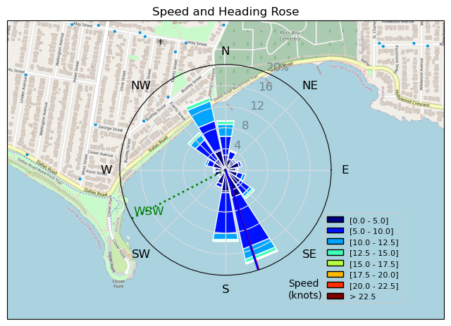
| Conditions | W 15-25, 1m swell |
| TOW | 1.0 hours |
| Toys | 2050sqcm Axis 1020mm Carbon Front Wing |
| 750mm Axis Aluminum Mast | |
| 5m Cabrinha X3 Windows | |
| 6.2m Cabrinha Mantis | |
| 115L JP Australia Foil Pro | |
| Details | Fantastic foiling day for a novice to try the swells at RB. Great sunshine, decent winds, good company with Danno and MtnarG. Consistently overpowered with the Cab6, but it's consistency made it easier to control. Had a much harder time when I switched to the Cab5, but swell period and amplitude seemed to have gotten tougher. A bit more confidence in heading into the swells and riding the roller coaster up and down. A little tougher for me to figure out riding with the swells. It's a learning thing. One of my best days on the water in a long time! [from Sailing Log on Tuesday February 21, 2023] |
Speed (3s average)
| Speed | knots | km/h |
|---|---|---|
| Avg overall | 2.8 | 5.3 |
| Avg in motion | 6.7 | 12.4 |
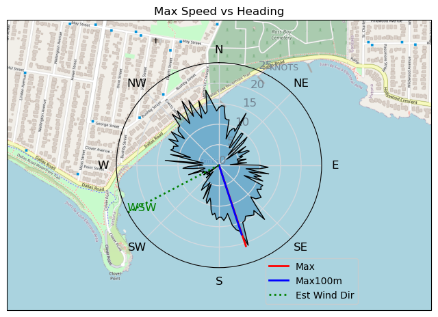
| Max | 20.8 | 38.5 |
| Max 100m | 14.4 | 26.6 |
| Max 250m | 11.1 | 20.6 |
| Max 500m | 9.8 | 18.1 |
| Max 2s | 19.9 | 36.8 |
| Max 10s | 16.1 | 29.7 |
| Max Alpha (500/50m) | 8.8 | 16.3 |
| Avg Foiling | 8.0 | 14.7 |
Times and Duration
| Start | Tue Feb 21, 3:25 AM |
| End | Tue Feb 21, 5:45 AM |
| Duration | 02:20:35 |
| In motion | 00:59:52 |
| Paused (< 3 km/h) | 01:20:40 |
| Foiling | 00:37:13 |
| Not Foiling (< 8 km/h) | 01:43:19 |
| Last Calculated | Tue Feb 21, 10:38 PM |
Track Information
| Distance | 12.3 km |
| # Trackpoints | 2987 |
| Avg Trackpoint distance | 4.1 m |
| Number of Turns | 48 |
| Foiling Turns (> 8 km/h) | 1 |
| Foiling Turn Percentage | 2% |


Category: Wingfoiling
2 years ago

Created 2 years ago
Highrocker |
Please register/login to download this track.
This track was downloaded 0 time(s). |
| 33 241120 Willows |
| 40 Willows Bomb Session |
| 42 Shoot the Entrance |
| 33 CloverPartDeux |
| 25 Come back soon Bombo |
Please wait while loading suggestions..
Please wait while loading suggestions..
You must login to post comments.