230317 Cattle Point
Highrocker - Wingfoil |
Friday March 17, 2023 10:42 AM |
| Spot | Cattle Pt |
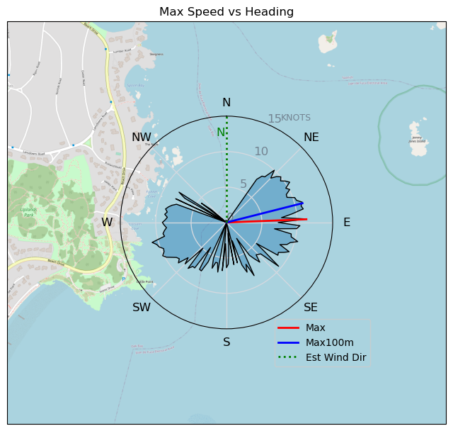
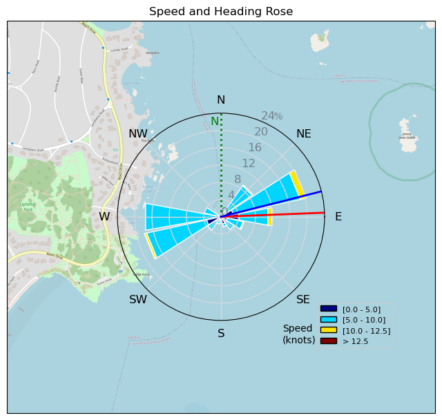
| Conditions | NNW 10-15, Mostly flat |
| TOW | 1.5 hours |
| Toys | 750mm Axis Aluminum Mast |
| 5m Cabrinha X3 Windows | |
| 6.2m Cabrinha Mantis | |
| 115L JP Australia Foil Pro | |
| Details | Looked iffy for my marginal skills, but the weekend forecast showed no promise. Bobson said Tweezer was out there in 10-15kt so I took the shot. And what a shot it was. Pretty consistent 15kt with my Cab6 meant almost immediate foiling once I sheeted in. Overpowered most of the time. Tweezer provided some supervision and showed off some jedi moves for the first 30 min. Once GoPro battery ran out, I switched to Cab 5. Bobson and Rupert were just putting in too. Slightly harder to get up on the 5m particularly near the end as the winds lightened. I had my wing choices backwards. Bob did his usual whooping high speed passes while I toddled along at walking pace. I finished off the 2nd GoPro battery and called it a day. A freakin' fantastic day in the spring sun! https://youtu.be/jBO34Hy44FY [from Sailing Log on Friday March 17, 2023] |
Speed (3s average)
| Speed | knots | km/h |
|---|---|---|
| Avg overall | 4.7 | 8.8 |
| Avg in motion | 7.3 | 13.4 |
| Max | 11.3 | 20.9 |
| Max 100m | 10.5 | 19.4 |
| Max 250m | 9.7 | 18.0 |
| Max 500m | 8.8 | 16.2 |
| Max 2s | 11.3 | 20.9 |
| Max 10s | 10.7 | 19.7 |
| Max Alpha (500/50m) | 8.2 | 15.3 |
| Avg Foiling | 7.5 | 13.8 |
Times and Duration
| Start | Fri Mar 17, 10:42 AM |
| End | Fri Mar 17, 12:45 PM |
| Duration | 02:03:12 |
| In motion | 01:20:20 |
| Paused (< 3 km/h) | 00:42:37 |
| Foiling | 01:06:38 |
| Not Foiling (< 8 km/h) | 00:56:19 |
| Last Calculated | Fri Mar 17, 11:02 PM |
Track Information
| Distance | 18.0 km |
| # Trackpoints | 936 |
| Avg Trackpoint distance | 19.2 m |
| Number of Turns | 22 |
| Foiling Turns (> 8 km/h) | 14 |
| Foiling Turn Percentage | 64% |


Category: Wingfoiling
2 years ago

Created 2 years ago
Highrocker |
Please register/login to download this track.
This track was downloaded 0 time(s). |
| 33 241120 Willows |
| 40 Willows Bomb Session |
| 41 Shoot the Entrance |
| 32 CloverPartDeux |
| 25 Come back soon Bombo |
Please wait while loading suggestions..
Please wait while loading suggestions..
You must login to post comments.