230328 Willows
Highrocker - Wingfoiling |
Tuesday March 28, 2023 12:32 PM |
| Spot | Willows Bch |
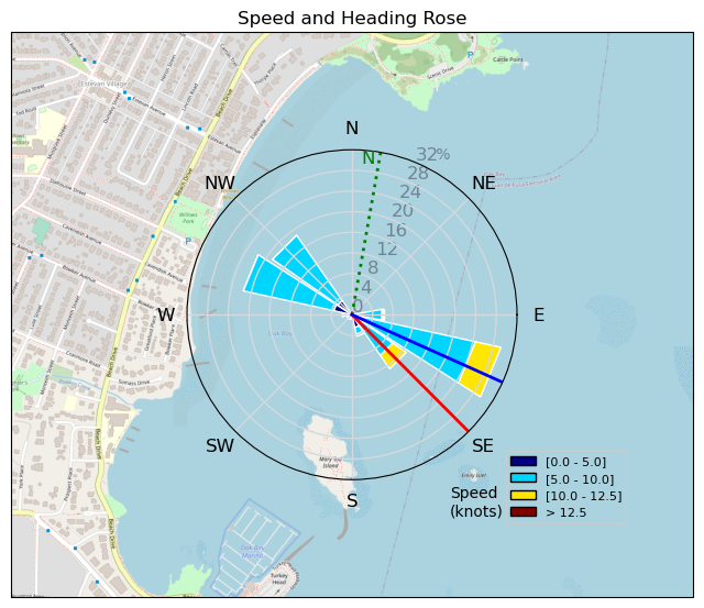
| Conditions | NE 12-18, flat to minimal chop |
| TOW | 2.0 hours |
| Toys | 2050sqcm Axis 1020mm Carbon Front Wing |
| 750mm Axis Aluminum Mast | |
| 5m Cabrinha X3 Windows | |
| 6.2m Cabrinha Mantis | |
| 115L JP Australia Foil Pro | |
| Details | Wind shift caused Danno, MtnarG, and I to switch from CP to Willows. Dan and I went 5m, while MtnarG went 6m. Downwind foil was good, upwind wasn't quite enough and we both switched to Cab6. Good choice. Continuous foiling for me, except for the gybes I can't do yet. Made it out to the channel markers on the islets where there was swell but the wind was more consistent in the high range. I could see Bobson at CP silhouetted by the magnificence of Mt. Baker. Pure enjoyment in the warm sun, brisk winds, and great company. [from Sailing Log on Tuesday March 28, 2023] |
Speed (3s average)
| Speed | knots | km/h |
|---|---|---|
| Avg overall | 3.4 | 6.4 |
| Avg in motion | 7.2 | 13.3 |
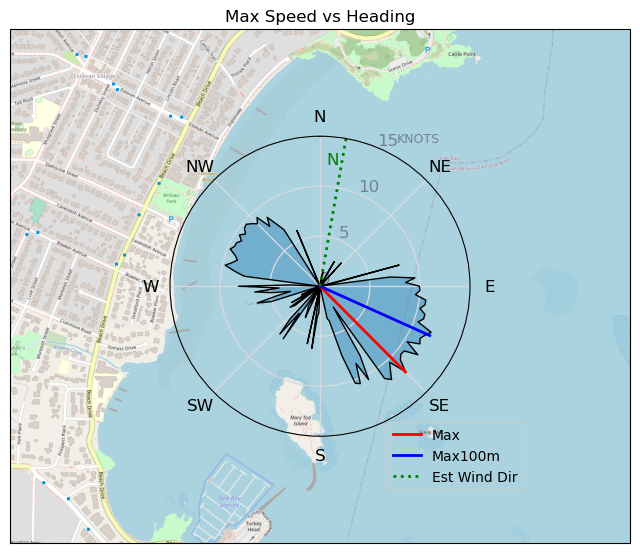
| Max | 12.1 | 22.4 |
| Max 100m | 11.7 | 21.7 |
| Max 250m | 10.7 | 19.9 |
| Max 500m | 9.9 | 18.4 |
| Max 2s | 12.1 | 22.4 |
| Max 10s | 11.9 | 22.1 |
| Max Alpha (500/50m) | 8.5 | 15.7 |
| Avg Foiling | 8.0 | 14.9 |
Times and Duration
| Start | Tue Mar 28, 12:32 PM |
| End | Tue Mar 28, 2:46 PM |
| Duration | 02:13:42 |
| In motion | 01:04:08 |
| Paused (< 3 km/h) | 01:09:31 |
| Foiling | 00:49:01 |
| Not Foiling (< 8 km/h) | 01:24:38 |
| Last Calculated | Tue Mar 28, 8:47 PM |
Track Information
| Distance | 14.2 km |
| # Trackpoints | 751 |
| Avg Trackpoint distance | 18.9 m |
| Number of Turns | 6 |
| Foiling Turns (> 8 km/h) | 1 |
| Foiling Turn Percentage | 17% |


Category: Wingfoiling
2 years ago

Created 2 years ago
Highrocker |
Please register/login to download this track.
This track was downloaded 0 time(s). |
| 34 241120 Willows |
| 42 Willows Bomb Session |
| 42 Shoot the Entrance |
| 33 CloverPartDeux |
| 25 Come back soon Bombo |
Please wait while loading suggestions..
Please wait while loading suggestions..
You must login to post comments.