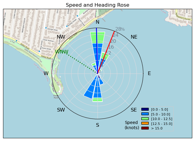
230403 Ross Bay
Highrocker - Wingfoiling |
Monday April 03, 2023 6:46 PM |
| Spot | Ross Bay |
| Conditions | SW 12-18, chop to 1.5m swell |
| TOW | 0.8 hours |
| Toys | 2050sqcm Axis 1020mm Carbon Front Wing |
| 750mm Axis Aluminum Mast | |
| 6m Cabrinha X3 Windows | |
| 115L JP Australia Foil Pro | |
| Details | I tried Willows first and that was glass. Got into the RB game very late - may have been the last winger in the water - likely past 630. But, the near future forecasts looked pathetic so I had to get a little bit of air. My 6mX3 was the perfect tool for me. No need to pump to fly and the wing was predictable in the gusts out by the point. I played in the swells and got a few sweet DH runs in. Still lots for me to learn. I need to get out there and just watch the pros and how it's done. Just a short session, but the sunset sail was sweet. I'll be doing that again for sure! I missed the usual aging suspects..... [from Sailing Log on Monday April 03, 2023] |
Speed (3s average)
| Speed | knots | km/h |
|---|---|---|
| Avg overall | 5.4 | 10.0 |
| Avg in motion | 7.6 | 14.0 |
| Max | 13.8 | 25.5 |
| Max 100m | 11.1 | 20.5 |
| Max 250m | 10.5 | 19.4 |
| Max 500m | 9.8 | 18.2 |
| Max 2s | 13.8 | 25.5 |
| Max 10s | 11.6 | 21.5 |
| Max Alpha (500/50m) | 8.4 | 15.6 |
| Avg Foiling | 8.3 | 15.3 |
Times and Duration
| Start | Mon Apr 03, 6:46 PM |
| End | Mon Apr 03, 7:35 PM |
| Duration | 00:48:53 |
| In motion | 00:34:47 |
| Paused (< 3 km/h) | 00:13:56 |
| Foiling | 00:28:43 |
| Not Foiling (< 8 km/h) | 00:20:00 |
| Last Calculated | Mon Apr 03, 10:02 PM |
Track Information
| Distance | 8.1 km |
| # Trackpoints | 441 |
| Avg Trackpoint distance | 18.4 m |
| Number of Turns | 9 |
| Foiling Turns (> 8 km/h) | 0 |
| Foiling Turn Percentage | 0% |


Category: Wingfoiling
2 years ago

Created 2 years ago
Highrocker |
Please register/login to download this track.
This track was downloaded 0 time(s). |
| 33 241120 Willows |
| 42 Willows Bomb Session |
| 42 Shoot the Entrance |
| 33 CloverPartDeux |
| 25 Come back soon Bombo |
Please wait while loading suggestions..
Please wait while loading suggestions..
You must login to post comments.