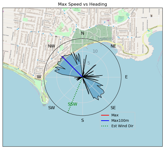
230429 Ross Bay
Highrocker - Wingfoiling |
Saturday April 29, 2023 3:07 PM |
| Spot | Ross Bay |
| Conditions | WNW 12-18, 1-4ft swell |
| TOW | 1.0 hours |
| Toys | 2050sqcm Axis 1020mm Carbon Front Wing |
| 750mm Axis Aluminum Mast | |
| 6m Cabrinha X3 Windows | |
| 115L JP Australia Foil Pro | |
| Details | I arrived a little bit later than the OG group. Warm sunshine and good winds. Bobson and Mtnarg were out first with mtnarg deploying his 8m beast. I followed Paul's, Greg's, and Gautam's lead and pulled out my own 6m. It was choppy in the bay and swelly out past the point. It was nearly immediate lifts with fun roller coaster swell rides out past the point. Lots of flotsam to deke around at the tide line. Got a few nice laps but the winds reduced after about an hour. Too little wind for my low skill level to get foiling through that swell. Really enjoyed the warm weather foiling with fine fellows. [from Sailing Log on Saturday April 29, 2023] |
Speed (3s average)
| Speed | knots | km/h |
|---|---|---|
| Avg overall | 5.2 | 9.7 |
| Avg in motion | 8.6 | 15.9 |
| Max | 11.4 | 21.1 |
| Max 100m | 11.2 | 20.6 |
| Max 250m | 10.7 | 19.9 |
| Max 500m | 10.3 | 19.0 |
| Max 2s | 11.4 | 21.1 |
| Max 10s | 11.3 | 20.9 |
| Max Alpha (500/50m) | 9.6 | 17.7 |
| Avg Foiling | 8.0 | 14.8 |
Times and Duration
| Start | Sat Apr 29, 3:07 PM |
| End | Sat Apr 29, 4:15 PM |
| Duration | 01:07:25 |
| In motion | 00:41:03 |
| Paused (< 3 km/h) | 00:26:08 |
| Foiling | 00:22:49 |
| Not Foiling (< 8 km/h) | 00:44:22 |
| Last Calculated | Sat Apr 29, 9:07 PM |
Track Information
| Distance | 10.9 km |
| # Trackpoints | 453 |
| Avg Trackpoint distance | 24.0 m |
| Number of Turns | 6 |
| Foiling Turns (> 8 km/h) | 3 |
| Foiling Turn Percentage | 50% |


Category: Wingfoiling
2 years ago

Created 2 years ago
Highrocker |
Please register/login to download this track.
This track was downloaded 0 time(s). |
| 37 241120 Willows |
| 44 Willows Bomb Session |
| 43 Shoot the Entrance |
| 35 CloverPartDeux |
| 25 Come back soon Bombo |
Please wait while loading suggestions..
Please wait while loading suggestions..
You must login to post comments.