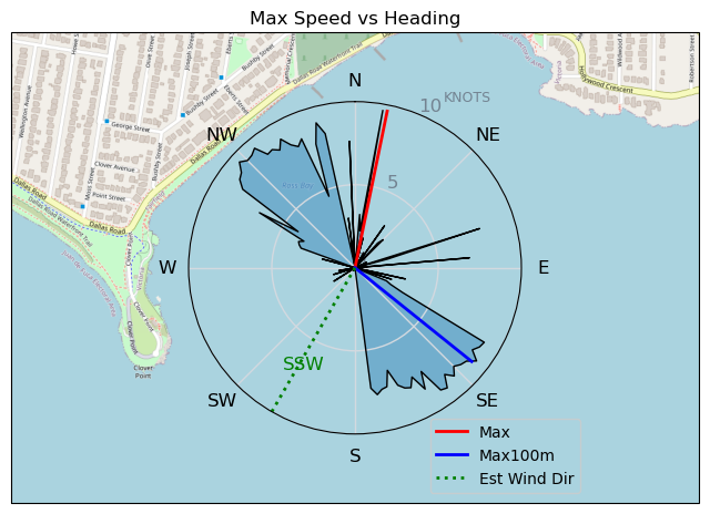
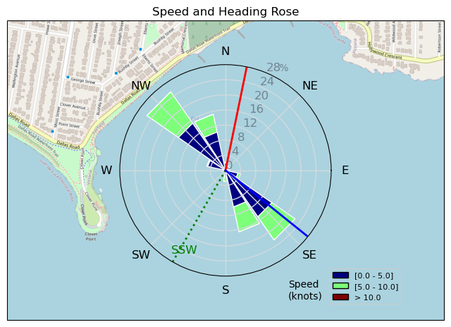
230509 ross Bay
Highrocker - Wingfoiling |
Tuesday May 09, 2023 5:37 PM |
| Spot | Ross Bay |
| Conditions | SW 6-14, 1-2ft swell |
| TOW | 1.0 hours |
| Toys | 2050sqcm Axis 1020mm Carbon Front Wing |
| 750mm Axis Aluminum Mast | |
| 6.2m Cabrinha Mantis | |
| 115L JP Australia Foil Pro | |
| Details | Idefix reported that Bobson was foiling on his big sail, so I headed for RB. But, by the time I got there, he had already left, unhappy with the wind. The wind seemed to be building and Bob was doing the Bob thing. So, I headed in and hoped my 6.2m of Cabrinha goodness would save my session. And, it did get me up with a lot of pumping encouragement. I got a couple of drunken monkey runs in and did my best to get in Bobson's way and stop him from a 50km session. Sadly, the winds subsided and I didn't have the skill to get foiling again with the light wind and swell effect. Tried to get up again couple of time but to no avail. Oh well, I did get flight, and that is always good. A little wind please! What kind of first world is this that can't even supply foilable winds..... [from Sailing Log on Tuesday May 09, 2023] |
Speed (3s average)
| Speed | knots | km/h |
|---|---|---|
| Avg overall | 3.6 | 6.7 |
| Avg in motion | 5.8 | 10.7 |
| Max | 9.6 | 17.8 |
| Max 100m | 9.0 | 16.6 |
| Max 250m | 8.8 | 16.3 |
| Max 500m | 8.6 | 15.9 |
| Max 2s | 9.6 | 17.8 |
| Max 10s | 9.2 | 17.0 |
| Max Alpha (500/50m) | 7.6 | 14.1 |
| Avg Foiling | 7.4 | 13.6 |
Times and Duration
| Start | Tue May 09, 5:37 PM |
| End | Tue May 09, 6:40 PM |
| Duration | 01:03:55 |
| In motion | 00:39:53 |
| Paused (< 3 km/h) | 00:23:31 |
| Foiling | 00:12:42 |
| Not Foiling (< 8 km/h) | 00:50:42 |
| Last Calculated | Tue May 09, 9:58 PM |
Track Information
| Distance | 7.1 km |
| # Trackpoints | 414 |
| Avg Trackpoint distance | 17.1 m |
| Number of Turns | 8 |
| Foiling Turns (> 8 km/h) | 1 |
| Foiling Turn Percentage | 12% |


Category: Wingfoiling
2 years ago

Created 2 years ago
Highrocker |
Please register/login to download this track.
This track was downloaded 0 time(s). |
| 39 241120 Willows |
| 46 Willows Bomb Session |
| 44 Shoot the Entrance |
| 37 CloverPartDeux |
| 25 Come back soon Bombo |
Please wait while loading suggestions..
Please wait while loading suggestions..
You must login to post comments.