230513 Cattle Point
Highrocker - Wingfoiling |
Saturday May 13, 2023 2:17 PM |
| Spot | Cattle Pt |
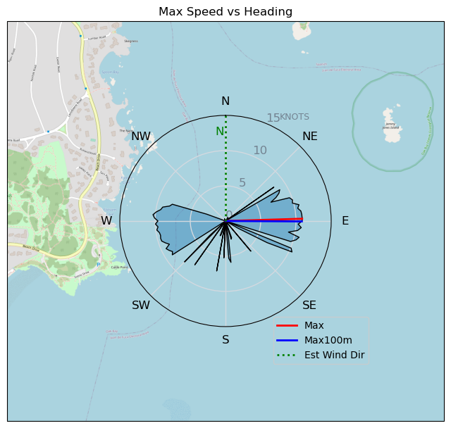
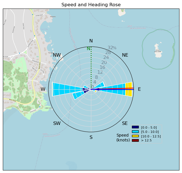
| Conditions | N 8-13, Mostly flat |
| TOW | 1.0 hours |
| Toys | 2050sqcm Axis 1020mm Carbon Front Wing |
| 750mm Axis Aluminum Mast | |
| 6.2m Cabrinha Mantis | |
| 115L JP Australia Foil Pro | |
| Details | It's not a good sign when Bobson's carrying gear out of the water and saying it's real light. But, I'm such a rebel that I went out anyways. Luckily, the wind gods smiled on me and gave me some PumpNFoil air. It was the best summer foiling this year, frolicking in shorts and t-shirt in the playground with a bunch of other water freaks! Endless foiling runs, with just a bit of pumping and broad reaching. Fun out there with John and RuppDog. Winds diminished a bit after about an hour and my pumping laziness caused me to call it a day. Cold bevys with RDog after made it a fine ending. More like this please! [from Sailing Log on Saturday May 13, 2023] |
Speed (3s average)
| Speed | knots | km/h |
|---|---|---|
| Avg overall | 5.7 | 10.5 |
| Avg in motion | 6.0 | 11.1 |
| Max | 10.9 | 20.1 |
| Max 100m | 10.8 | 20.1 |
| Max 250m | 10.6 | 19.7 |
| Max 500m | 10.1 | 18.7 |
| Max 2s | 10.9 | 20.1 |
| Max 10s | 10.9 | 20.1 |
| Max Alpha (500/50m) | 8.7 | 16.1 |
| Avg Foiling | 8.1 | 15.1 |
Times and Duration
| Start | Sat May 13, 2:17 PM |
| End | Sat May 13, 3:09 PM |
| Duration | 00:51:35 |
| In motion | 00:48:49 |
| Paused (< 3 km/h) | 00:02:17 |
| Foiling | 00:27:06 |
| Not Foiling (< 8 km/h) | 00:24:00 |
| Last Calculated | Sat May 13, 11:56 PM |
Track Information
| Distance | 9.0 km |
| # Trackpoints | 497 |
| Avg Trackpoint distance | 18.2 m |
| Number of Turns | 3 |
| Foiling Turns (> 8 km/h) | 1 |
| Foiling Turn Percentage | 33% |


Category: Wingfoiling
2 years ago

Created 2 years ago
Highrocker |
Please register/login to download this track.
This track was downloaded 0 time(s). |
| 40 241120 Willows |
| 47 Willows Bomb Session |
| 45 Shoot the Entrance |
| 39 CloverPartDeux |
| 26 Come back soon Bombo |
Please wait while loading suggestions..
Please wait while loading suggestions..
You must login to post comments.