Coors Light
TunaCan - Wingfoiling |
Tuesday May 30, 2023 7:22 PM |
| Spot | Ross Bay |
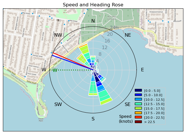
| Conditions | WNW 15-20, knee high |
| TOW | 1.0 hours |
| Toys | 95cm Mast Axis |
| 1210cm Foil Takuma | |
| 5 OR GLIDE | |
| 5'3 Takuma TK 80 | |
| Details | Arrived to the young foil shred lords Bougie and Sam finishing up their sessions. Thought I wouldnt have anybody to evening session with, until JJ showed up ready to go and looking stoked! Very gusty session, mostly overpowered on the 5m. I need to switch my wing leash to my waist as it feels like it rips my shoulder / wrist when it yanks away while i'm floundering around after a fall. Really enjoying the foot straps and working on jumping, taking some practice to learn how to land them overpowered, but slowly getting there. Took me 4 attempts but, I was able to ride away from olliing over the Scotchman down in the bay. Reminded me of skating - so freaking fun. [from Sailing Log on Tuesday May 30, 2023] |
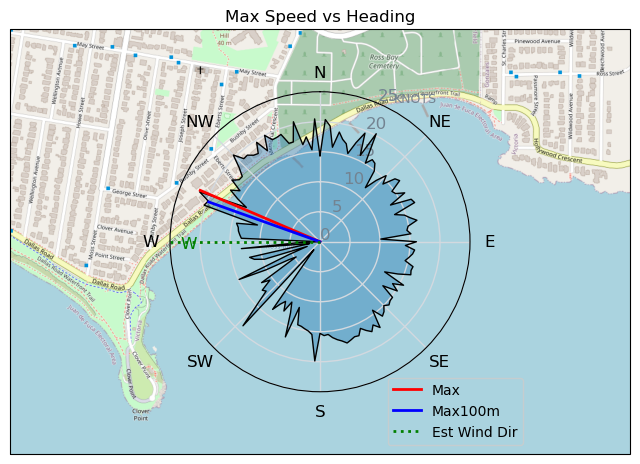
Speed (3s average)
| Speed | knots | km/h |
|---|---|---|
| Avg overall | 9.3 | 17.3 |
| Avg in motion | 10.6 | 19.7 |
| Max | 21.7 | 40.2 |
| Max 100m | 20.2 | 37.4 |
| Max 250m | 19.9 | 36.8 |
| Max 500m | 17.4 | 32.3 |
| Max 2s | 21.1 | 39.0 |
| Max 10s | 20.2 | 37.4 |
| Max Alpha (500/50m) | 17.4 | 32.3 |
| Avg Foiling | 12.8 | 23.7 |
Times and Duration
| Start | Tue May 30, 7:22 PM |
| End | Tue May 30, 8:29 PM |
| Duration | 01:06:47 |
| In motion | 00:58:50 |
| Paused (< 3 km/h) | 00:07:39 |
| Foiling | 00:45:14 |
| Not Foiling (< 8 km/h) | 00:21:15 |
| Last Calculated | Tue May 30, 9:39 PM |
Track Information
| Distance | 19.3 km |
| # Trackpoints | 3781 |
| Avg Trackpoint distance | 5.1 m |
| Number of Turns | 78 |
| Foiling Turns (> 8 km/h) | 41 |
| Foiling Turn Percentage | 53% |


Category: Wingfoiling
one year ago

Created one year ago
TunaCan |
Please register/login to download this track.
This track was downloaded 0 time(s). |
| 39 241120 Willows |
| 46 Willows Bomb Session |
| 44 Shoot the Entrance |
| 38 CloverPartDeux |
| 25 Come back soon Bombo |
Please wait while loading suggestions..
Please wait while loading suggestions..
You must login to post comments.