Shoulda been there
TunaCan - Wingfoiling |
Sunday July 09, 2023 5:07 PM |
| Spot | Ross Bay |
| Conditions | SW 10-25, 2-3 |
| TOW | 2.0 hours |
| Toys | 5'3 Takuma TK 80 |
| Details | First session was pretty mid (as the kids say). Lots of kelp and holes in the wind, although a bunch of sailors and stoke out there. The shore bubble formed and completely killed the wind and Tweezer and I got caught out up at Clover with a swim in. Had a beer on the beach and everybody left except for JJ and myself. Decided to head back out and and it truly delivered. Weeds moved out, wind was consistent 18-25plus and swell was waist high and groomed - couldnt believe the change in conditions. Kiters were scoring - lots of hoots and HUGE airs coming from them. Landed a couple Railey airs which I was super excited about. Super sick session - one to remember. [from Sailing Log on Sunday July 09, 2023] |
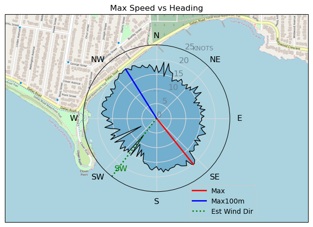
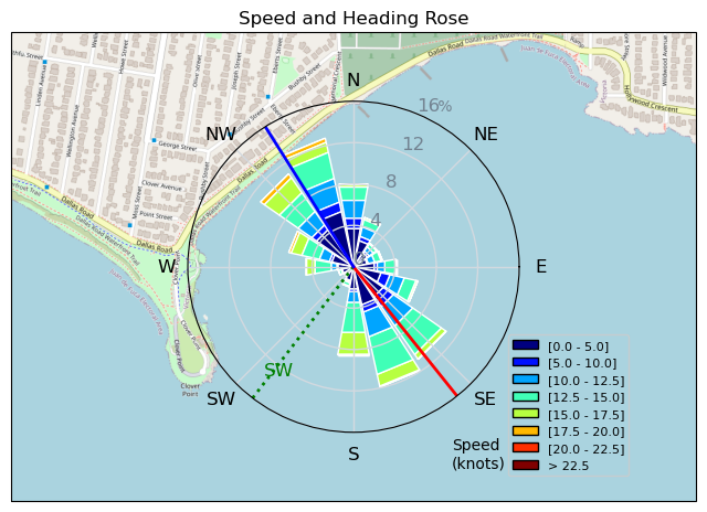
Speed (3s average)
| Speed | knots | km/h |
|---|---|---|
| Avg overall | 6.9 | 12.7 |
| Avg in motion | 10.2 | 18.9 |
| Max | 20.1 | 37.2 |
| Max 100m | 18.3 | 33.8 |
| Max 250m | 17.0 | 31.4 |
| Max 500m | 15.8 | 29.3 |
| Max 2s | 20.0 | 37.0 |
| Max 10s | 18.6 | 34.4 |
| Max Alpha (500/50m) | 15.7 | 29.0 |
| Avg Foiling | 12.5 | 23.2 |
Times and Duration
| Start | Sun Jul 09, 5:07 PM |
| End | Sun Jul 09, 8:31 PM |
| Duration | 03:24:20 |
| In motion | 02:17:06 |
| Paused (< 3 km/h) | 01:05:57 |
| Foiling | 01:41:53 |
| Not Foiling (< 8 km/h) | 01:41:10 |
| Last Calculated | Sun Jul 09, 9:28 PM |
Track Information
| Distance | 43.3 km |
| # Trackpoints | 9861 |
| Avg Trackpoint distance | 4.4 m |
| Number of Turns | 197 |
| Foiling Turns (> 8 km/h) | 99 |
| Foiling Turn Percentage | 50% |


Category: Wingfoiling
one year ago

Created one year ago
TunaCan |
Please register/login to download this track.
This track was downloaded 0 time(s). |
| 10 aCloverBalmyBombo |
| 12 Maytag day at IV 20241122 |
| 8 Bomba Bueno |
| 7 Log-a-slog |
| 8 East to SE and strong! |
Please wait while loading suggestions..
Please wait while loading suggestions..
You must login to post comments.