Nitinat Recovery Session
slake - Wingfoiling |
Friday July 28, 2023 12:43 PM |
| Spot | Nitinat Lk |
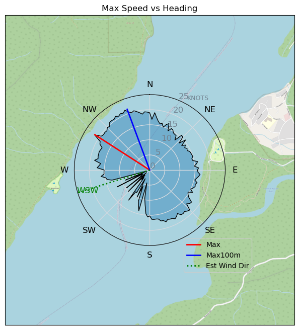
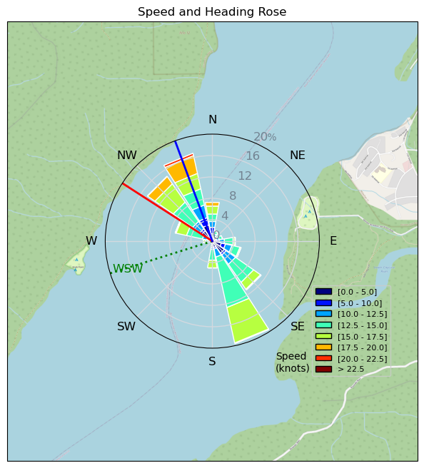
| Conditions | SW 15-22, flat to 2' |
| TOW | 4.0 hours |
| Toys | Armstrong HA925 |
| 3m Duotone Slick | |
| 5'5" 88L Armstrong Wing SUP | |
| Details | Tried Heineken gybes on weak side, passable, and heel side tacks on strong side, mostly wipeouts with one passable tack. Been shimmed with one red/one blue this week (ie. +1.5 deg) and I find heel side tacking a lot harder with the small foil and small wing. Much easier with the HS1850 in lighter air with a 5 or 6 m wing. Tried to go faster today during the "recovery session" but won't be able to tell until I upload the track. A lot fun playing in waves toward the downwind end of the lake. Good wind at Nitinat, again. [from Sailing Log on Friday July 28, 2023] |
Speed (3s average)
| Speed | knots | km/h |
|---|---|---|
| Avg overall | 8.1 | 15.1 |
| Avg in motion | 12.6 | 23.3 |
| Max | 21.6 | 40.0 |
| Max 100m | 20.9 | 38.7 |
| Max 250m | 20.5 | 38.1 |
| Max 500m | 20.2 | 37.4 |
| Max 2s | 21.6 | 40.0 |
| Max 10s | 20.9 | 38.7 |
| Max Alpha (500/50m) | 16.0 | 29.7 |
| Avg Foiling | 14.1 | 26.1 |
Times and Duration
| Start | Fri Jul 28, 12:43 PM |
| End | Fri Jul 28, 6:53 PM |
| Duration | 06:09:08 |
| In motion | 03:58:48 |
| Paused (< 3 km/h) | 02:08:58 |
| Foiling | 03:24:46 |
| Not Foiling (< 8 km/h) | 02:43:00 |
| Last Calculated | Fri Jul 28, 9:19 PM |
Track Information
| Distance | 92.8 km |
| # Trackpoints | 7688 |
| Avg Trackpoint distance | 12.1 m |
| Number of Turns | 157 |
| Foiling Turns (> 8 km/h) | 102 |
| Foiling Turn Percentage | 65% |


Category: Wingfoiling
one year ago

Created one year ago
slake |
Please register/login to download this track.
This track was downloaded 0 time(s). |
Please wait while loading suggestions..
Please wait while loading suggestions..
You must login to post comments.