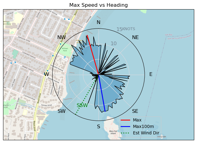
231016 Willows
Highrocker - Wingfoiling |
Monday October 16, 2023 4:19 PM |
| Spot | Willows Bch |
| Conditions | WSW 10-18, pancake flat |
| TOW | 1.5 hours |
| Toys | 2050sqcm Axis 1020mm Carbon Front Wing |
| 750mm Axis Aluminum Mast | |
| 6.2m Cabrinha Mantis | |
| 115L JP Australia Foil Pro | |
| Details | I was initially at Esq Lagoon when the front came in and the 30kt offshore gusts quickly made me run away with my tail between my legs to Willows where Paul and GMan said there were foilable winds. There was barely enough for my limited skills. GMan and Paul were getting occasional foils. That should have told me to go with my biggest wing. Regardless, there was lots of pumping needed to get up and stay up. Still nice to get out with the OGs! I detected no poo sign but then I have 3rd world roots. [from Sailing Log on Monday October 16, 2023] |
Speed (3s average)
| Speed | knots | km/h |
|---|---|---|
| Avg overall | 3.9 | 7.2 |
| Avg in motion | 5.3 | 9.8 |
| Max | 13.3 | 24.6 |
| Max 100m | 11.9 | 22.0 |
| Max 250m | 11.1 | 20.6 |
| Max 500m | 10.0 | 18.5 |
| Max 2s | 13.2 | 24.4 |
| Max 10s | 12.2 | 22.7 |
| Max Alpha (500/50m) | 9.8 | 18.1 |
| Avg Foiling | 8.1 | 15.0 |
Times and Duration
| Start | Mon Oct 16, 4:19 PM |
| End | Mon Oct 16, 5:56 PM |
| Duration | 01:36:55 |
| In motion | 01:11:24 |
| Paused (< 3 km/h) | 00:23:42 |
| Foiling | 00:32:13 |
| Not Foiling (< 8 km/h) | 01:02:53 |
| Longest Foiling Segment | 00:03:11 (849 m) |
| Last Calculated | Mon Oct 16, 8:26 PM |
Track Information
| Distance | 11.6 km |
| # Trackpoints | 1187 |
| Avg Trackpoint distance | 9.8 m |
| Number of Turns | 25 |
| Foiling Turns (> 8 km/h) | 10 |
| Foiling Turn Percentage | 40% |


Category: Wingfoiling
one year ago

Created one year ago
Highrocker |
Please register/login to download this track.
This track was downloaded 0 time(s). |
Please wait while loading suggestions..
Please wait while loading suggestions..
You must login to post comments.