231027 Willows
Highrocker - Wingfoiling |
Friday October 27, 2023 10:56 AM |
| Spot | Willows Bch |
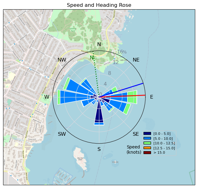
| Conditions | NE 9-18, flat to 0.5m swell |
| TOW | 1.0 hours |
| Toys | 2050sqcm Axis 1020mm Carbon Front Wing |
| 750mm Axis Aluminum Mast | |
| 6.2m Cabrinha Mantis | |
| 115L JP Australia Foil Pro | |
| Details | Another wonderful time on the water in summerlike sunshine with mild winds in the bay and actionable winds out beyond Cattle Point. Glad to share the swells with Lancer and Paul. Bobson was rippin' it, as usual, off Cad Bay, just a bit too far for me upwind to reach him with my time constraints. There were nicely accommodating swells of CP that let me get in some more flagging practice. Still a long way away from flagging competence, but a sliver of light is showing. The only sad bit was my limited time available to wing! [from Sailing Log on Friday October 27, 2023] |
Speed (3s average)
| Speed | knots | km/h |
|---|---|---|
| Avg overall | 5.7 | 10.6 |
| Avg in motion | 7.5 | 13.9 |
| Max | 12.8 | 23.6 |
| Max 100m | 11.6 | 21.5 |
| Max 250m | 10.4 | 19.3 |
| Max 500m | 10.0 | 18.5 |
| Max 2s | 12.8 | 23.6 |
| Max 10s | 12.0 | 22.2 |
| Max Alpha (500/50m) | 8.8 | 16.2 |
| Avg Foiling | 8.5 | 15.7 |
Times and Duration
| Start | Fri Oct 27, 10:56 AM |
| End | Fri Oct 27, 12:23 PM |
| Duration | 01:26:50 |
| In motion | 01:06:08 |
| Paused (< 3 km/h) | 00:17:43 |
| Foiling | 00:53:59 |
| Not Foiling (< 8 km/h) | 00:29:52 |
| Longest Foiling Segment | 00:07:44 (2.2 km) |
| Last Calculated | Fri Oct 27, 5:38 PM |
Track Information
| Distance | 15.4 km |
| # Trackpoints | 1448 |
| Avg Trackpoint distance | 10.6 m |
| Number of Turns | 40 |
| Foiling Turns (> 8 km/h) | 29 |
| Foiling Turn Percentage | 72% |


Category: Wingfoiling
one year ago

Created one year ago
Highrocker |
Please register/login to download this track.
This track was downloaded 0 time(s). |
| 38 Sweet 700MA! |
| 26 RB Nov 11 |
| 40 Nice 1150cm2 and 5m session. |
| 40 IV - more freakin porpoises |
| 48 241111 Ross Bay |
Please wait while loading suggestions..
Please wait while loading suggestions..
You must login to post comments.