Nov or Sept?
TunaCan - Wingfoiling |
Saturday November 04, 2023 2:04 PM |
| Spot | Ross Bay |
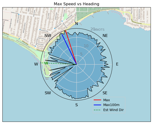
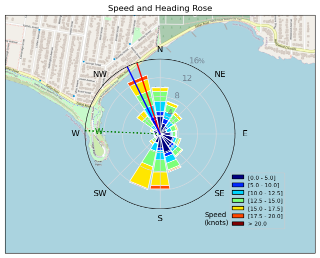
| Conditions | WSW 15-20, 1-2 |
| TOW | 1.0 hours |
| Toys | 5 OR GLIDE |
| 5'3 Takuma TK 80 | |
| Details | Wasnt expecting much today. Turned into a fun quick session. Tried out a 200 V tail without a shim and just didnt fill right, made my way in after 10 mins to change it out to the regular 235. I need to get a smaller tail.. maybe 200 or smaller. So warm, no hood or gloves, was toasty the whole time in the 5mm. Should have taken the straps off so not to tempt myself into a couple jumps, because that is what flared up the ribs / ab injury for the rest of the session. More tomorrow hopefully. Oh, saw a friggin' double rainbow on my way home. [from Session Log on Saturday November 04, 2023] |
Speed (3s average)
| Speed | knots | km/h |
|---|---|---|
| Avg overall | 8.9 | 16.5 |
| Avg in motion | 11.2 | 20.7 |
| Max | 20.0 | 37.0 |
| Max 100m | 18.9 | 35.1 |
| Max 250m | 18.3 | 33.9 |
| Max 500m | 17.1 | 31.7 |
| Max 2s | 19.7 | 36.5 |
| Max 10s | 19.0 | 35.2 |
| Max Alpha (500/50m) | 16.9 | 31.3 |
| Avg Foiling | 13.1 | 24.3 |
Times and Duration
| Start | Sat Nov 04, 2:04 PM |
| End | Sat Nov 04, 3:27 PM |
| Duration | 01:22:43 |
| In motion | 01:05:53 |
| Paused (< 3 km/h) | 00:15:48 |
| Foiling | 00:52:07 |
| Not Foiling (< 8 km/h) | 00:29:34 |
| Longest Foiling Segment | 00:09:30 (4.1 km) |
| Last Calculated | Sat Nov 04, 9:20 PM |
Track Information
| Distance | 22.7 km |
| # Trackpoints | 4738 |
| Avg Trackpoint distance | 4.8 m |
| Number of Turns | 94 |
| Foiling Turns (> 8 km/h) | 46 |
| Foiling Turn Percentage | 49% |


Category: Wingfoiling
one year ago

Created one year ago
TunaCan |
Please register/login to download this track.
This track was downloaded 0 time(s). |
Please wait while loading suggestions..
Please wait while loading suggestions..
You must login to post comments.