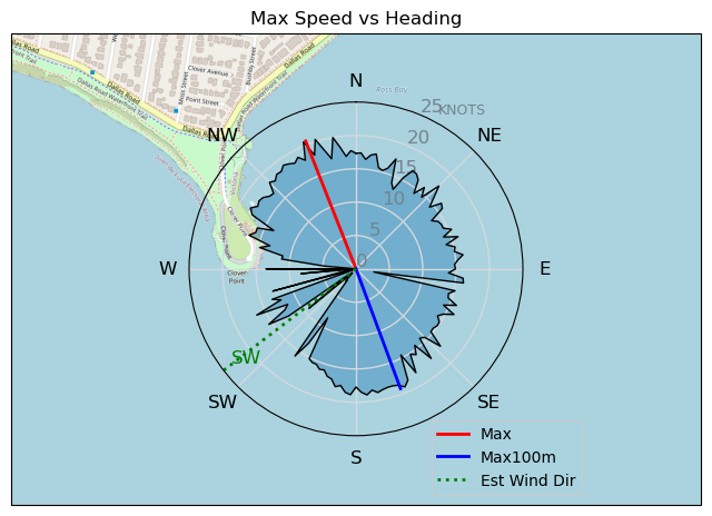
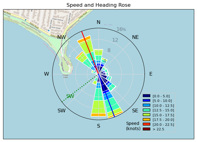
Sunday Funday
TunaCan - Wingfoiling |
Sunday December 03, 2023 1:53 PM |
| Spot | Ross Bay |
| Conditions | WSW 8-15, 1-2 |
| TOW | 0.5 hours |
| Toys | 5 OR GLIDE |
| 5'3 Takuma TK 80 | |
| Details | Looked iffy when I arrived. Heavy crew of locals on the goat hill. Chatted for 30 mins, and then got rigged, as consensus was that it would pickup when current system moved through. Blew up my "new to me" 3.5 slingshot with boom - looks sweet, and then the wind filled in. Didnt get to use it tho - super fun session up at the point with a good crew of maybe 10 wings out? Consistent fun wind up at the point. Was feeling sendy on a couple jumps. I love RB. [from Session Log on Sunday December 03, 2023] |
Speed (3s average)
| Speed | knots | km/h |
|---|---|---|
| Avg overall | 9.5 | 17.5 |
| Avg in motion | 11.3 | 20.9 |
| Max | 20.6 | 38.1 |
| Max 100m | 18.5 | 34.3 |
| Max 250m | 16.9 | 31.3 |
| Max 500m | 16.4 | 30.4 |
| Max 2s | 20.5 | 37.9 |
| Max 10s | 18.6 | 34.5 |
| Max Alpha (500/50m) | 15.5 | 28.7 |
| Avg Foiling | 13.6 | 25.1 |
Times and Duration
| Start | Sun Dec 03, 1:53 PM |
| End | Sun Dec 03, 2:42 PM |
| Duration | 00:48:51 |
| In motion | 00:41:05 |
| Paused (< 3 km/h) | 00:07:34 |
| Foiling | 00:31:38 |
| Not Foiling (< 8 km/h) | 00:17:01 |
| Longest Foiling Segment | 00:09:22 (4.0 km) |
| Last Calculated | Sun Dec 03, 3:17 PM |
Track Information
| Distance | 14.3 km |
| # Trackpoints | 2868 |
| Avg Trackpoint distance | 5.0 m |
| Number of Turns | 68 |
| Foiling Turns (> 8 km/h) | 40 |
| Foiling Turn Percentage | 59% |


Category: Wingfoiling
12 months ago

Created 12 months ago
TunaCan |
Please register/login to download this track.
This track was downloaded 0 time(s). |
| 8 20241114 |
| 3 NewWingDay |
| 41 Sweet 700MA! |
| 29 RB Nov 11 |
| 42 Nice 1150cm2 and 5m session. |
Please wait while loading suggestions..
Please wait while loading suggestions..
You must login to post comments.