Perfd
TunaCan - Wingfoiling |
Friday December 22, 2023 11:07 AM |
| Spot | Ross Bay |
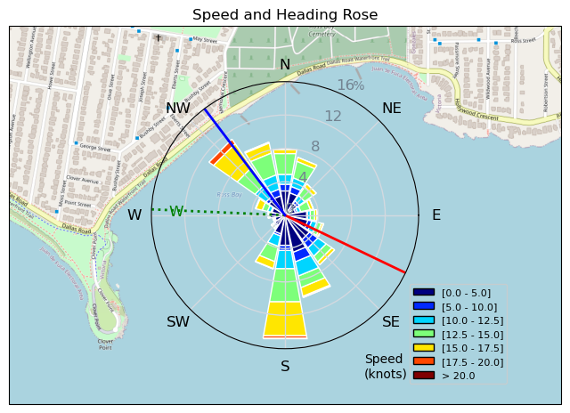
| Conditions | WSW 20-25, 3-4 |
| TOW | 1.5 hours |
| Details | Great session. Very overpowered on the 5m at first, but gave me confidence to ride the growing swells very deep into the bay which was fun. Finally decided to come in and switch down to 3.5 but realized I left my boom at home. Ripped back to grab it, and was having a great second half to session until I came down from like 7ft to a direct impact on my left ear. Think I perforated it though the helmet and hood which is crazy. Unfortunately out of the water likely for the next little bit, which is sucks because lots of wind on tap for Christmas break! [from Session Log on Friday December 22, 2023] |
Speed (3s average)
| Speed | knots | km/h |
|---|---|---|
| Avg overall | 5.9 | 11.0 |
| Avg in motion | 10.7 | 19.8 |
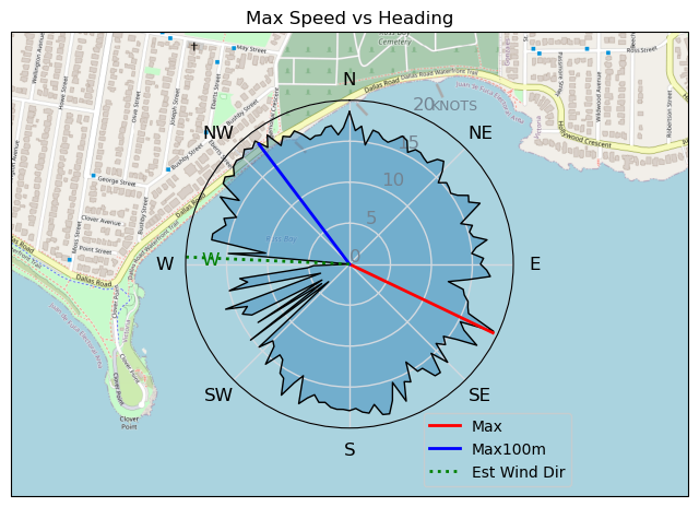
| Max | 19.4 | 35.9 |
| Max 100m | 18.2 | 33.7 |
| Max 250m | 17.0 | 31.5 |
| Max 500m | 16.3 | 30.1 |
| Max 2s | 19.4 | 35.9 |
| Max 10s | 18.2 | 33.7 |
| Max Alpha (500/50m) | 14.9 | 27.6 |
| Avg Foiling | 12.8 | 23.6 |
Times and Duration
| Start | Fri Dec 22, 11:07 AM |
| End | Fri Dec 22, 12:43 PM |
| Duration | 01:36:18 |
| In motion | 00:53:19 |
| Paused (< 3 km/h) | 00:41:34 |
| Foiling | 00:40:55 |
| Not Foiling (< 8 km/h) | 00:53:58 |
| Longest Foiling Segment | 00:05:03 (2.2 km) |
| Last Calculated | Fri Dec 22, 4:46 PM |
Track Information
| Distance | 17.6 km |
| # Trackpoints | 3848 |
| Avg Trackpoint distance | 4.6 m |
| Number of Turns | 76 |
| Foiling Turns (> 8 km/h) | 28 |
| Foiling Turn Percentage | 37% |


Category: Wingfoiling
11 months ago

Created 11 months ago
TunaCan |
Please register/login to download this track.
This track was downloaded 0 time(s). |
| 9 20241114 |
| 3 NewWingDay |
| 41 Sweet 700MA! |
| 29 RB Nov 11 |
| 42 Nice 1150cm2 and 5m session. |
Please wait while loading suggestions..
Please wait while loading suggestions..
You must login to post comments.