right turn only
AJSpencer - Wingfoiling |
Wednesday December 27, 2023 12:53 PM |
| Spot | Pat Bay |
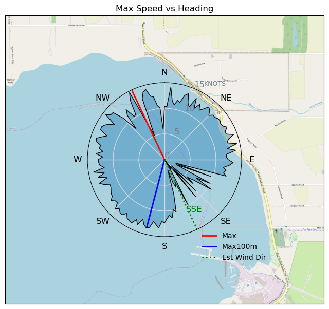
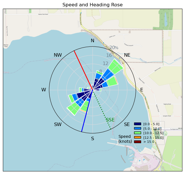
| Conditions | SSE 10-30, flat |
| TOW | 2.5 hours |
| Toys | 105 Axis Mast |
| 1010 Axis PNG | |
| 4.0 Duotone Slick | |
| 105 Quatro Wing Drifter | |
| Details | A bit too much like lake sailing for the first half. Had Mtnarg and team show up for some company. As soon as I heard someone deflate the wind dialled up a bit and improved ' thank you for that. Was a bit too South most of the time but finally swung more SE and filled in but was up and down all day. Had some breakthroughs, landing all flying footswitches port-to-starboard and finally attempted some starboard-to-port but a long way off that side still. Overall awesome day despite gaps in the wind. [from Session Log on Wednesday December 27, 2023] |
Speed (3s average)
| Speed | knots | km/h |
|---|---|---|
| Avg overall | 5.6 | 10.3 |
| Avg in motion | 7.7 | 14.3 |
| Max | 14.8 | 27.3 |
| Max 100m | 13.4 | 24.8 |
| Max 250m | 12.1 | 22.4 |
| Max 500m | 11.7 | 21.7 |
| Max 2s | 14.6 | 27.0 |
| Max 10s | 13.5 | 25.0 |
| Max Alpha (500/50m) | 10.6 | 19.7 |
| Avg Foiling | 9.8 | 18.2 |
Times and Duration
| Start | Wed Dec 27, 12:53 PM |
| End | Wed Dec 27, 3:22 PM |
| Duration | 02:29:00 |
| In motion | 01:47:20 |
| Paused (< 3 km/h) | 00:41:08 |
| Foiling | 01:10:53 |
| Not Foiling (< 8 km/h) | 01:17:35 |
| Longest Foiling Segment | 00:06:13 (2.0 km) |
| Last Calculated | Wed Dec 27, 4:01 PM |
Track Information
| Distance | 25.6 km |
| # Trackpoints | 8877 |
| Avg Trackpoint distance | 2.9 m |
| Number of Turns | 73 |
| Foiling Turns (> 8 km/h) | 6 |
| Foiling Turn Percentage | 8% |


Category: Wingfoiling
11 months ago

Created 11 months ago
AJSpencer |
Please register/login to download this track.
This track was downloaded 0 time(s). |
| 23 241124 Willows |
| 27 WillowsQuickie |
| 25 Willows - Sunday Funday Woops |
| 25 Willows Mixed Bag |
| 20 Surprise Sunday ENE. |
Please wait while loading suggestions..
Please wait while loading suggestions..
You must login to post comments.