Stabby Clover
bwd - Wingfoiling |
Wednesday December 27, 2023 11:38 AM |
| Spot | Clover Pt |
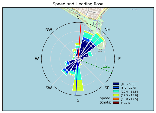
| Conditions | SE 15-25, 4ft with some confusion |
| TOW | 1.0 hours |
| Toys | 935 Armstrong Performance |
| 60 Armstrong Fuse | |
| 800 Armstrong MA | |
| 205 Armstrong SURF | |
| 3.5 Cabrinha Mantis V2 | |
| 2.5 Cabrinha Mantis V2 | |
| 60L Armstrong FG 4-11 | |
| Details | I was hoping for a windier version of Monday but it didn't happen. Felt dialed on the 3.5 and it was super fun at first, but then I got a stab wound on the wing and by the time I sailed in it had ripped to xl size. Oh well the wind is coming up so the 2.5 will be perfect. It was not. I drifted around and swore a lot, and then the wind completely died and I swam in. It came back enough for the dream team to get out but I was done. [from Session Log on Wednesday December 27, 2023] |
Speed (3s average)
| Speed | knots | km/h |
|---|---|---|
| Avg overall | 4.8 | 8.8 |
| Avg in motion | 7.9 | 14.6 |
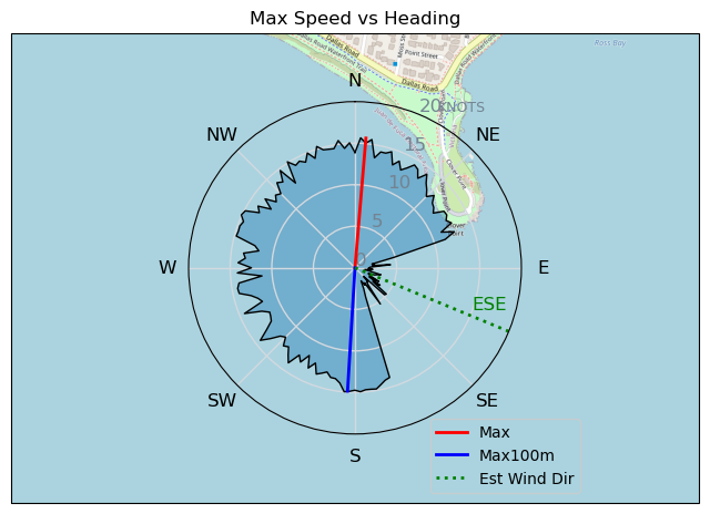
| Max | 15.7 | 29.0 |
| Max 100m | 14.7 | 27.1 |
| Max 250m | 13.7 | 25.3 |
| Max 500m | 13.1 | 24.3 |
| Max 2s | 15.6 | 28.9 |
| Max 10s | 14.9 | 27.6 |
| Max Alpha (500/50m) | 12.3 | 22.7 |
| Avg Foiling | 11.1 | 20.5 |
Times and Duration
| Start | Wed Dec 27, 11:38 AM |
| End | Wed Dec 27, 1:16 PM |
| Duration | 01:37:48 |
| In motion | 00:59:07 |
| Paused (< 3 km/h) | 00:37:45 |
| Foiling | 00:33:39 |
| Not Foiling (< 8 km/h) | 01:03:13 |
| Longest Foiling Segment | 00:04:41 (1.7 km) |
| Last Calculated | Wed Dec 27, 4:58 PM |
Track Information
| Distance | 14.4 km |
| # Trackpoints | 5184 |
| Avg Trackpoint distance | 2.8 m |
| Number of Turns | 108 |
| Foiling Turns (> 8 km/h) | 42 |
| Foiling Turn Percentage | 39% |


Category: Wingfoiling
11 months ago

Created 11 months ago
bwd |
Please register/login to download this track.
This track was downloaded 0 time(s). |
| 9 20241114 |
| 3 NewWingDay |
| 41 Sweet 700MA! |
| 29 RB Nov 11 |
| 42 Nice 1150cm2 and 5m session. |
Please wait while loading suggestions..
Please wait while loading suggestions..
You must login to post comments.