big for PB
AJSpencer - Wingfoiling |
Tuesday January 09, 2024 12:20 PM |
| Spot | Pat Bay |
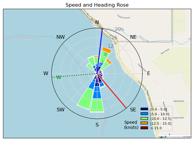
| Conditions | WNW 20-30, RB ish |
| TOW | 1.2 hours |
| Toys | 105 Axis Mast |
| 1010 Axis PNG | |
| 4.0 Duotone Slick | |
| 105 Quatro Wing Drifter | |
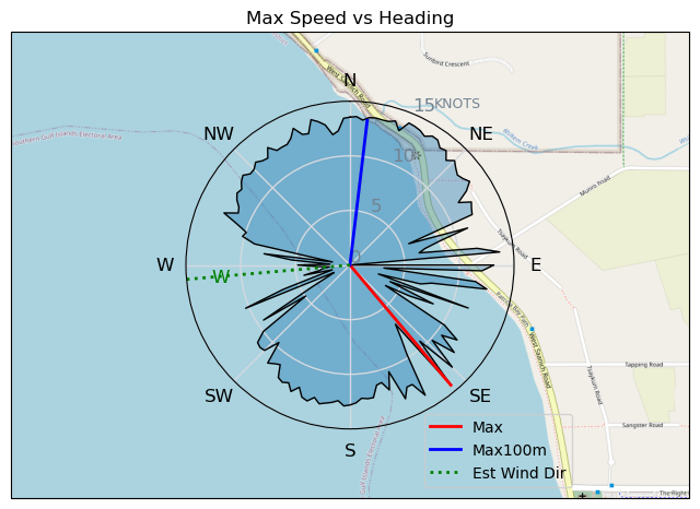
| Details | Been so long since a big W in Pat Bay. Looked flat from shore so kept the 1010 on but once out I definitely should have swapped for the 860SP. Decent size, somewhat rideable at first, then it clocked a little more NW and they started stacking together. Had some fun short rides. Lots of debris from high tide, and murky waters. Snagged a garbage bag and brought it home. Saved an engine or a blowhole! Thanks BWD for getting the server on battery power! [from Session Log on Tuesday January 09, 2024] |
Speed (3s average)
| Speed | knots | km/h |
|---|---|---|
| Avg overall | 7.0 | 13.0 |
| Avg in motion | 8.6 | 15.9 |
| Max | 14.3 | 26.6 |
| Max 100m | 13.4 | 24.7 |
| Max 250m | 13.2 | 24.4 |
| Max 500m | 12.7 | 23.5 |
| Max 2s | 14.0 | 26.0 |
| Max 10s | 13.5 | 25.0 |
| Max Alpha (500/50m) | 10.0 | 18.6 |
| Avg Foiling | 10.3 | 19.0 |
Times and Duration
| Start | Tue Jan 09, 12:20 PM |
| End | Tue Jan 09, 1:39 PM |
| Duration | 01:19:16 |
| In motion | 01:04:59 |
| Paused (< 3 km/h) | 00:13:42 |
| Foiling | 00:48:53 |
| Not Foiling (< 8 km/h) | 00:29:48 |
| Longest Foiling Segment | 00:02:31 (828 m) |
| Last Calculated | Tue Jan 09, 2:15 PM |
Track Information
| Distance | 17.2 km |
| # Trackpoints | 4669 |
| Avg Trackpoint distance | 3.7 m |
| Number of Turns | 68 |
| Foiling Turns (> 8 km/h) | 3 |
| Foiling Turn Percentage | 4% |


Category: Wingfoiling
11 months ago

Created 11 months ago
AJSpencer |
Please register/login to download this track.
This track was downloaded 0 time(s). |
Please wait while loading suggestions..
Please wait while loading suggestions..
You must login to post comments.