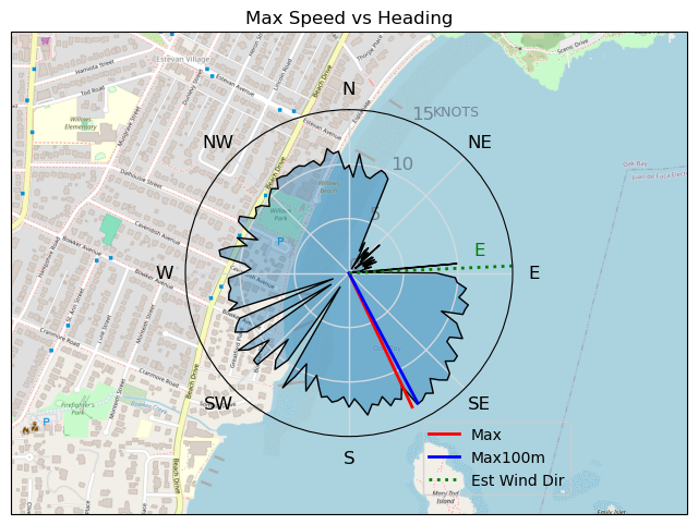
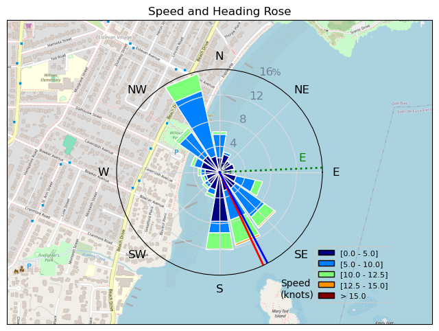
240216 Willows Beach
Highrocker - Wingfoiling |
Friday February 16, 2024 9:52 AM |
| Spot | Willows Bch |
| Conditions | NE 15-20, Mostly flat |
| TOW | 1.0 hours |
| Toys | 900mm Axis Aluminum Mast |
| 2050sqcm Axis 1020mm Carbon Front Wing | |
| 6m Cabrinha X3 Windows | |
| 115L JP Australia Foil Pro | |
| Details | Just WOW! Best conditions for me this year and I only had 1hr free. Shared the foiling joy with Tuna and Lancer and Idefix was just getting in as I was exiting. Mildly OP'd with my small 6m, but I wasn't risking a pumpfest with such a short foiling window for me. Wind line nearly at beach with nearly immediate lift for me with the big foil. Went out to islets and found the winds a bit reduced. Best winds were at MTI level to 50m off beach. Tuna was rippin' it as Tuna does! Lancer getting lots of lift! [from Session Log on Friday February 16, 2024] |
Speed (3s average)
| Speed | knots | km/h |
|---|---|---|
| Avg overall | 5.1 | 9.5 |
| Avg in motion | 8.2 | 15.2 |
| Max | 13.6 | 25.2 |
| Max 100m | 12.3 | 22.7 |
| Max 250m | 11.3 | 21.0 |
| Max 500m | 10.7 | 19.8 |
| Max 2s | 13.5 | 25.1 |
| Max 10s | 13.1 | 24.2 |
| Max Alpha (500/50m) | 10.5 | 19.5 |
| Avg Foiling | 8.9 | 16.5 |
Times and Duration
| Start | Fri Feb 16, 9:52 AM |
| End | Fri Feb 16, 11:13 AM |
| Duration | 01:21:26 |
| In motion | 00:50:59 |
| Paused (< 3 km/h) | 00:23:06 |
| Foiling | 00:43:23 |
| Not Foiling (< 8 km/h) | 00:30:42 |
| Longest Foiling Segment | 00:14:42 (4.4 km) |
| Last Calculated | Fri Feb 16, 1:34 PM |
Track Information
| Distance | 12.9 km |
| # Trackpoints | 2543 |
| Avg Trackpoint distance | 5.1 m |
| Number of Turns | 63 |
| Foiling Turns (> 8 km/h) | 27 |
| Foiling Turn Percentage | 43% |


Category: Wingfoiling
9 months ago

Created 9 months ago
Highrocker |
Please register/login to download this track.
This track was downloaded 0 time(s). |
Please wait while loading suggestions..
Please wait while loading suggestions..
You must login to post comments.