Helpless, helpless
AJSpencer - Wingfoiling |
Sunday April 28, 2024 11:04 AM |
| Spot | Pat Bay |
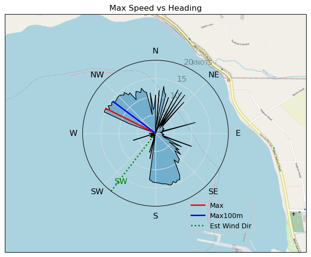
| Conditions | WSW 15-1, flat |
| TOW | 0.6 hours |
| Toys | 300 Axis Rear Performance |
| 999 Axis Art | |
| 105 Axis Mast | |
| 6.5 Duotone Slick | |
| 105 Quatro Wing Drifter | |
| Details | Got to Pat Bay 8am and wind was much too South. Dropped dog off at home and made the journey into Vic to find Ross Bay unaccessible for TC10k run. Drop to Cattle but didn't look good, Ross Bay was the only place to be I think. Drove back to PB, listened to Neil Young marathon. Still bad, went home to use bathroom and wait for updated forecast model2. 11am still looked promising so went back to PB. Wind came up exactly at 11am but did have the appearance of a prolonged gust. Had a few runs despite the small foil. Not enough skill/wind to make gybes. Once got a little ways out wind tanked. Long slog/wait back. Deflated and it picked up again but similar to before. Crappy wind day. Have to work in afternoon. Hopefully others had better luck today! [from Session Log on Sunday April 28, 2024] |
Speed (3s average)
| Speed | knots | km/h |
|---|---|---|
| Avg overall | 3.2 | 5.9 |
| Avg in motion | 6.2 | 11.4 |
| Max | 15.3 | 28.3 |
| Max 100m | 14.3 | 26.4 |
| Max 250m | 13.9 | 25.7 |
| Max 500m | 13.9 | 25.7 |
| Max 2s | 15.2 | 28.2 |
| Max 10s | 14.5 | 26.9 |
| Max Alpha (500/50m) | 10.0 | 18.5 |
| Avg Foiling | 11.9 | 21.9 |
Times and Duration
| Start | Sun Apr 28, 11:04 AM |
| End | Sun Apr 28, 11:57 AM |
| Duration | 00:52:32 |
| In motion | 00:27:03 |
| Paused (< 3 km/h) | 00:25:24 |
| Foiling | 00:08:39 |
| Not Foiling (< 8 km/h) | 00:43:48 |
| Longest Foiling Segment | 00:02:24 (938 m) |
| Last Calculated | Sun Apr 28, 12:42 PM |
Track Information
| Distance | 5.1 km |
| # Trackpoints | 1327 |
| Avg Trackpoint distance | 3.9 m |
| Number of Turns | 5 |
| Foiling Turns (> 8 km/h) | 0 |
| Foiling Turn Percentage | 0% |


Category: Wingfoiling
7 months ago

Created 7 months ago
AJSpencer |
Please register/login to download this track.
This track was downloaded 0 time(s). |
| 38 Swell beckons |
| 31 Clover week |
| 41 Double rainbowwww |
| 32 aCloverBalmyBombo |
| 28 Maytag day at IV 20241122 |
Please wait while loading suggestions..
Please wait while loading suggestions..
You must login to post comments.