Even more swells
tweezer - Wingfoiling |
Wednesday June 26, 2024 8:13 AM |
| Spot | [Secret spot] |
| Conditions | W 20-35, 2-6ft |
| TOW | 3.0 hours |
| Toys | 325/62 Axis 325p rear |
| 1038cm2 Axis ART 999 | |
| 56cm Axis Sillyshort Advance fuse | |
| 93 Nolimitz V3 | |
| 2.0 Cabrinha Mantis | |
| 3.5 Cabrinha Mantis | |
| 4ft9 65l Appletree Custom | |
| Details | Up at dawn - ok 6. Coffee then back to the hatch. First session in the morning was 2m. Looking downwind you could see clouds of spray being lifted off the surface by the event site. Later session on 3.5. Swells were big and smooth in spots. Reminded me of clover se conditions but 20 degrees warmer! Wingdoc downwind paddling in the morning - getting some long rides! Rblocal can't believe his good fortune to find Hood River. [from Session Log on Wednesday June 26, 2024] |
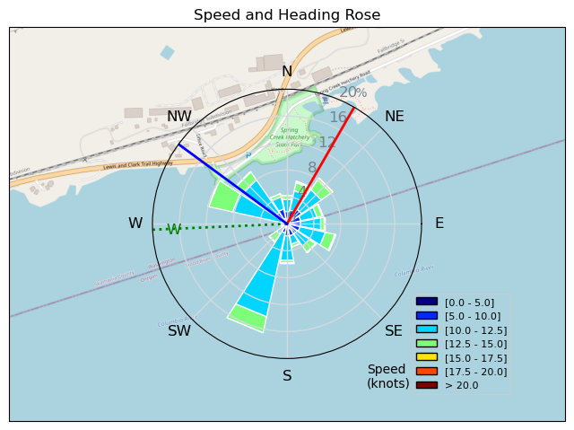
Speed (3s average)
| Speed | knots | km/h |
|---|---|---|
| Avg overall | 4.6 | 8.6 |
| Avg in motion | 10.6 | 19.7 |
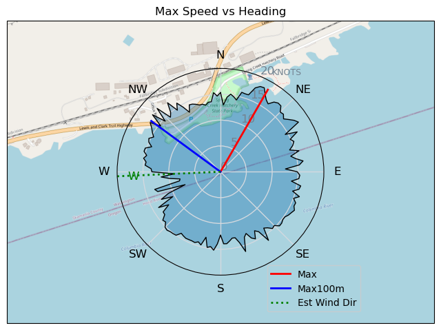
| Max | 18.3 | 33.9 |
| Max 100m | 15.1 | 28.0 |
| Max 250m | 13.7 | 25.4 |
| Max 500m | 13.1 | 24.2 |
| Max 2s | 18.3 | 33.8 |
| Max 10s | 15.9 | 29.4 |
| Max Alpha (500/50m) | 12.3 | 22.7 |
| Avg Foiling | 11.1 | 20.6 |
Times and Duration
| Start | Wed Jun 26, 8:13 AM |
| End | Wed Jun 26, 3:09 PM |
| Duration | 06:55:27 |
| In motion | 03:00:43 |
| Paused (< 3 km/h) | 03:53:53 |
| Foiling | 02:47:13 |
| Not Foiling (< 8 km/h) | 04:07:23 |
| Longest Foiling Segment | 00:23:15 (8.3 km) |
| Last Calculated | Fri Jun 28, 2:18 PM |
Track Information
| Distance | 59.3 km |
| # Trackpoints | 10644 |
| Avg Trackpoint distance | 5.6 m |
| Number of Turns | 214 |
| Foiling Turns (> 8 km/h) | 193 |
| Foiling Turn Percentage | 90% |


Category: Wingfoiling
5 months ago

Created 5 months ago
tweezer |
Please register/login to download this track.
This track was downloaded 0 time(s). |
| 11 Swell beckons |
| 15 Clover week |
| 35 Double rainbowwww |
| 30 aCloverBalmyBombo |
| 28 Maytag day at IV 20241122 |
Please wait while loading suggestions..
Please wait while loading suggestions..
You must login to post comments.