20240630
ThePope - Wingfoiling |
Sunday June 30, 2024 12:05 PM |
| Spot | Ross Bay |
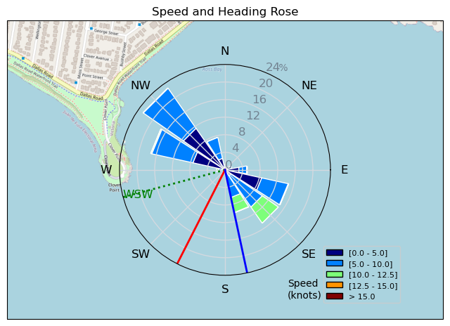
| Conditions | SW 12-16, 1m |
| TOW | 1.8 hours |
| Toys | Popemobile |
| 235 Armstrong Flow | |
| 865 Armstrong Mast | |
| 70 Armstrong Fuse | |
| 1475 Armstrong MA | |
| 7m Duotone Ventis | |
| 99L Armstrong FG Wing SUP | |
| Details | Had to be off the water by 2pm so I took the early shift and was the only one on the water until Grant joined towards to the end of my session. Things started a bit sloggy but improved quite a bit after 45 min when the wind picked up about 5 knots and I had plenty of power with my 7m. The slogging was ok because it forced me to continue to work on my pumping technique, especially the foot component which I'm still not consistently dialling in. Lots of kelp and debris in the tide line today, and it felt like there was some weird current thing going on leading to my foil feeling less stable than normal. Making progress on gybing and toeside but still have a ways to go. [from Session Log on Sunday June 30, 2024] |
Speed (3s average)
| Speed | knots | km/h |
|---|---|---|
| Avg overall | 4.7 | 8.7 |
| Avg in motion | 6.3 | 11.6 |
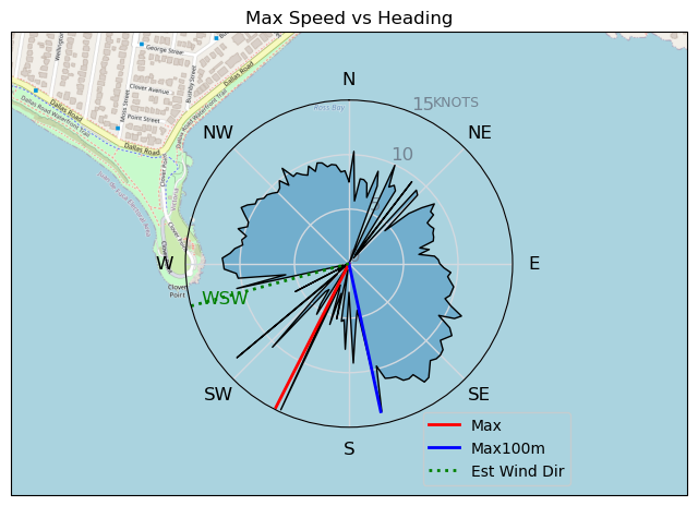
| Max | 14.8 | 27.4 |
| Max 100m | 12.2 | 22.6 |
| Max 250m | 11.1 | 20.6 |
| Max 500m | 10.4 | 19.3 |
| Max 2s | 14.3 | 26.5 |
| Max 10s | 12.1 | 22.4 |
| Max Alpha (500/50m) | 8.6 | 15.9 |
| Avg Foiling | 8.1 | 15.0 |
Times and Duration
| Start | Sun Jun 30, 12:05 PM |
| End | Sun Jun 30, 1:58 PM |
| Duration | 01:53:04 |
| In motion | 01:24:07 |
| Paused (< 3 km/h) | 00:28:52 |
| Foiling | 00:49:27 |
| Not Foiling (< 8 km/h) | 01:03:32 |
| Longest Foiling Segment | 00:02:33 (659 m) |
| Last Calculated | Sun Jun 30, 3:31 PM |
Track Information
| Distance | 16.3 km |
| # Trackpoints | 4213 |
| Avg Trackpoint distance | 3.9 m |
| Number of Turns | 23 |
| Foiling Turns (> 8 km/h) | 1 |
| Foiling Turn Percentage | 4% |


Category: Wingfoiling
5 months ago

Created 5 months ago
ThePope |
Please register/login to download this track.
This track was downloaded 0 time(s). |
| 11 Swell beckons |
| 15 Clover week |
| 35 Double rainbowwww |
| 30 aCloverBalmyBombo |
| 28 Maytag day at IV 20241122 |
Please wait while loading suggestions..
Please wait while loading suggestions..
You must login to post comments.