240630 China Creek
Highrocker - Wingfoiling |
Sunday June 30, 2024 11:43 AM |
| Spot | China Ck |
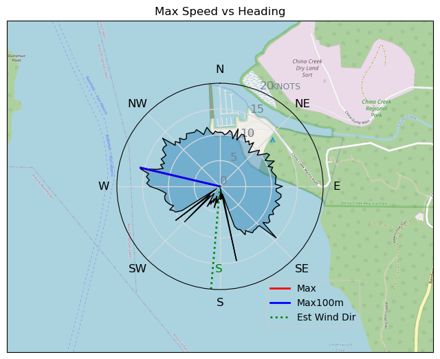
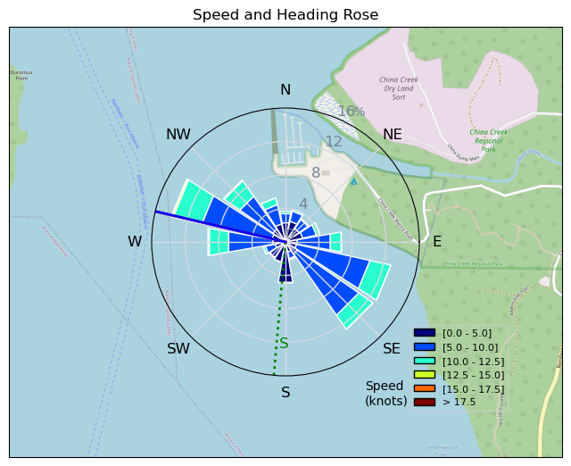
| Conditions | N 14-21, 1-2ft chop |
| TOW | 3.0 hours |
| Toys | 900mm Axis Aluminum Mast |
| 2050sqcm Axis 1020mm Carbon Front Wing | |
| 6m Cabrinha X3 Windows | |
| 6.2m Cabrinha Mantis | |
| 115L JP Australia Foil Pro | |
| Details | Best day of my CC vaycay! Sunny, hot, lots of wind, good friends, and a Bobson to chase. Still choppy and that made for a few short flags. Tremendous fun and beer and lunch in between sessions made for a happy foiler. Lots of flow state moments while pushing my carving limits in the strong winds. Wonderful shorty wetsuit sessions. Lots of fishing boats, but luckily there was lots of space for everyone. Really nice wind destination when the sun and winds are out. I'll be back...... [from Session Log on Sunday June 30, 2024] |
Speed (3s average)
| Speed | knots | km/h |
|---|---|---|
| Avg overall | 3.7 | 6.9 |
| Avg in motion | 8.4 | 15.6 |
| Max | 15.8 | 29.3 |
| Max 100m | 14.5 | 26.9 |
| Max 250m | 13.7 | 25.4 |
| Max 500m | 11.8 | 21.9 |
| Max 2s | 15.8 | 29.3 |
| Max 10s | 15.0 | 27.8 |
| Max Alpha (500/50m) | 11.0 | 20.4 |
| Avg Foiling | 8.9 | 16.6 |
Times and Duration
| Start | Sun Jun 30, 11:43 AM |
| End | Sun Jun 30, 5:36 PM |
| Duration | 05:52:43 |
| In motion | 02:35:40 |
| Paused (< 3 km/h) | 03:11:48 |
| Foiling | 02:18:08 |
| Not Foiling (< 8 km/h) | 03:29:20 |
| Longest Foiling Segment | 00:22:27 (6.2 km) |
| Last Calculated | Wed Jul 03, 12:43 AM |
Track Information
| Distance | 40.4 km |
| # Trackpoints | 4249 |
| Avg Trackpoint distance | 9.5 m |
| Number of Turns | 134 |
| Foiling Turns (> 8 km/h) | 102 |
| Foiling Turn Percentage | 76% |


Category: Wingfoiling
5 months ago

Created 5 months ago
Highrocker |
Please register/login to download this track.
This track was downloaded 0 time(s). |
Please wait while loading suggestions..
Please wait while loading suggestions..
You must login to post comments.