20240806v3
ThePope - Wingfoiling |
Tuesday August 06, 2024 3:23 PM |
| Spot | Nitinat Lk |
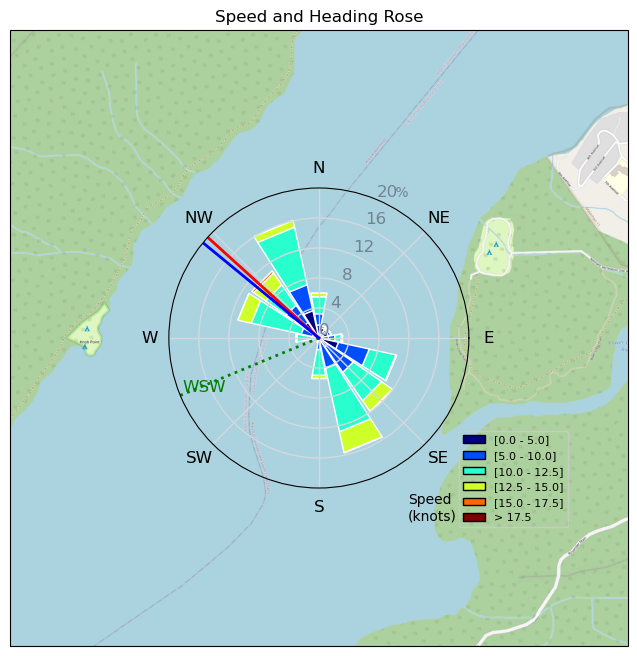
| Conditions | SW 20-25, 0.5m |
| TOW | 2.5 hours |
| Toys | 235 Armstrong Flow |
| 865 Armstrong Mast | |
| 70 Armstrong Fuse | |
| 1225 Armstrong MA | |
| 4m Duotone Unit | |
| 99L Armstrong FG Wing SUP | |
| Details | Awesome start to three days at Nitinaht. First barefoot session ever. Lots of fun racing my kitesurfer sister Wendy and partner Adrian. Circumnavigated the island a la Tweezer, then was shocked when all the sudden Mark appeared out of nowhere to come say hi. Is this the Nitinaht magic people speak of? ULR also at the Nat ' I'd recognize the gold helmet anywhere. I think I improved on some of my stats for the BWD leaderboard today. Tomorrow: gybefest. [from Session Log on Tuesday August 06, 2024] |
Speed (3s average)
| Speed | knots | km/h |
|---|---|---|
| Avg overall | 6.6 | 12.2 |
| Avg in motion | 9.0 | 16.6 |
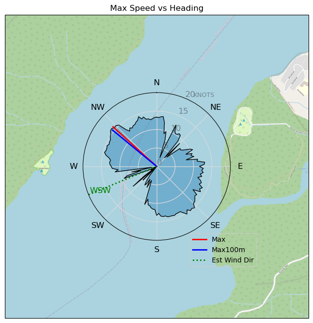
| Max | 16.0 | 29.6 |
| Max 100m | 15.5 | 28.6 |
| Max 250m | 15.2 | 28.1 |
| Max 500m | 14.5 | 26.9 |
| Max 2s | 15.8 | 29.3 |
| Max 10s | 15.6 | 28.9 |
| Max Alpha (500/50m) | 10.5 | 19.4 |
| Avg Foiling | 10.2 | 18.9 |
Times and Duration
| Start | Tue Aug 06, 3:23 PM |
| End | Tue Aug 06, 6:01 PM |
| Duration | 02:38:27 |
| In motion | 01:56:07 |
| Paused (< 3 km/h) | 00:42:19 |
| Foiling | 01:32:06 |
| Not Foiling (< 8 km/h) | 01:06:20 |
| Longest Foiling Segment | 00:06:04 (2.0 km) |
| Last Calculated | Wed Aug 07, 11:42 AM |
Track Information
| Distance | 32.1 km |
| # Trackpoints | 6431 |
| Avg Trackpoint distance | 5.0 m |
| Number of Turns | 34 |
| Foiling Turns (> 8 km/h) | 4 |
| Foiling Turn Percentage | 12% |


Category: Wingfoiling
4 months ago

Created 4 months ago
ThePope |
Please register/login to download this track.
This track was downloaded 0 time(s). |
| 24 241120 Willows |
| 32 Willows Bomb Session |
| 32 Shoot the Entrance |
| 26 CloverPartDeux |
| 16 Come back soon Bombo |
Please wait while loading suggestions..
Please wait while loading suggestions..
You must login to post comments.