241101 Willows
Highrocker - Wingfoiling |
Friday November 01, 2024 10:39 AM |
| Spot | Willows Bch |
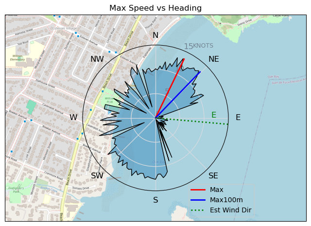
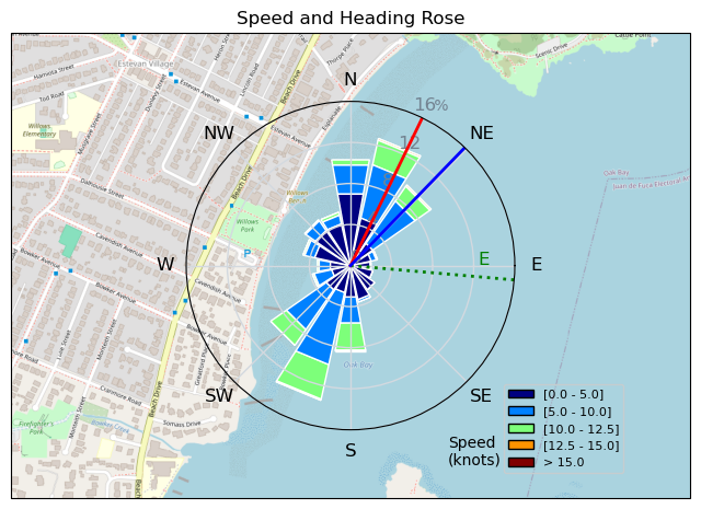
| Conditions | SE 8-14, Mostly flat |
| TOW | 1.0 hours |
| Toys | 115L JP Australia Foil Pro |
| 6.2m Cabrinha Mantis | |
| 2050sqcm Axis 1020mm Carbon Front Wing | |
| 900mm Axis Aluminum Mast | |
| Details | Typical Willows parking lot winds teasing you to rig 4-5m, but a walk down to the beach and the wind drops 5kts. MtnarG had a few touchdowns and slogs on his 8m and that made me to go big. Thankfully! My biggest wing was the right choice. Actually, my big gear and little man combo was ideal for the light onshore winds. It doesn't go too fast, strains the arms, and ain't too sexy, but the lifts are immediate, foiling jibes still work under 10kts, and slogging is a rarity, not the norm. Good OG fun! [from Session Log on Friday November 01, 2024] |
Speed (3s average)
| Speed | knots | km/h |
|---|---|---|
| Avg overall | 5.1 | 9.4 |
| Avg in motion | 7.6 | 14.0 |
| Max | 13.5 | 24.9 |
| Max 100m | 12.6 | 23.4 |
| Max 250m | 12.2 | 22.6 |
| Max 500m | 11.1 | 20.6 |
| Max 2s | 13.5 | 24.9 |
| Max 10s | 13.0 | 24.1 |
| Max Alpha (500/50m) | 10.9 | 20.1 |
| Avg Foiling | 8.8 | 16.3 |
Times and Duration
| Start | Fri Nov 01, 10:39 AM |
| End | Fri Nov 01, 11:53 AM |
| Duration | 01:13:34 |
| In motion | 00:49:17 |
| Paused (< 3 km/h) | 00:23:01 |
| Foiling | 00:35:58 |
| Not Foiling (< 8 km/h) | 00:36:20 |
| Longest Foiling Segment | 00:07:47 (2.2 km) |
| Last Calculated | Fri Nov 01, 3:05 PM |
Track Information
| Distance | 11.5 km |
| # Trackpoints | 1711 |
| Avg Trackpoint distance | 6.7 m |
| Number of Turns | 35 |
| Foiling Turns (> 8 km/h) | 27 |
| Foiling Turn Percentage | 77% |


Category: Wingfoiling
3 weeks ago

Created 3 weeks ago
Highrocker |
Please register/login to download this track.
This track was downloaded 0 time(s). |
| 20 241120 Willows |
| 24 Willows Bomb Session |
| 29 Shoot the Entrance |
| 23 CloverPartDeux |
| 13 Come back soon Bombo |
Please wait while loading suggestions..
Please wait while loading suggestions..
You must login to post comments.