morning at RB
TunaCan - Wingfoiling |
Thursday January 16, 2025 9:22 AM |
| Spot | Ross Bay |
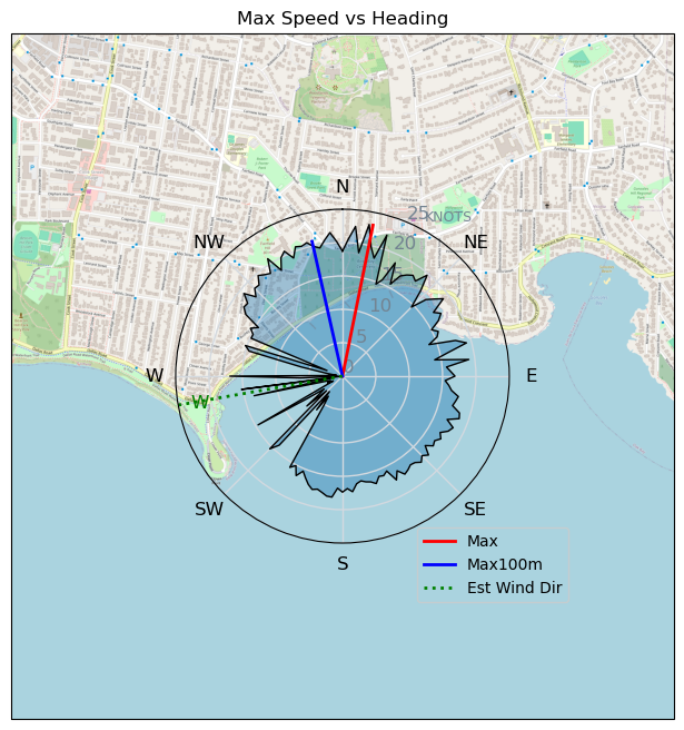
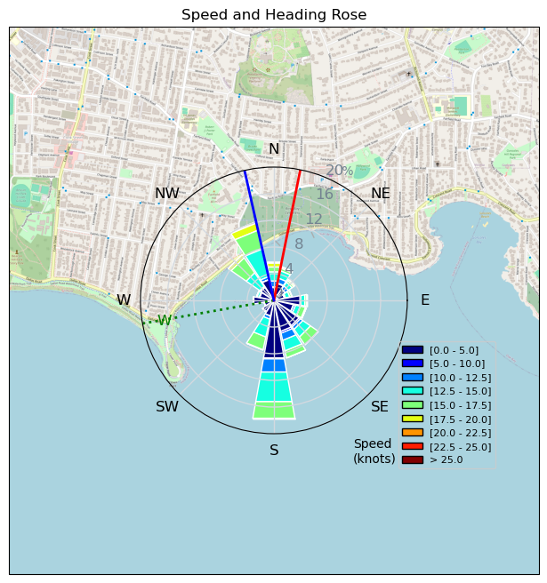
| Conditions | WNW 20-30, 1 |
| TOW | 1.0 hours |
| Details | Tweezer beat me out there for the morning session. He came in and told me it was pretty windy, but i thought it would die within the hour, so stayed with the 5M and bigger 1225 foil. Turns out he was right - it was near 30kts off the point. Came in and put on the MA1000 that i need to return, and took my gloves off to help with the arm pump with the massively overpowered 5m. Hands stayed pretty warm, and cruised around the bay looking for some lighter winds and more swell. Came in with thoughts of grabbing the 3.5m from home and some snacks. 15 mins later and I was back and but it was dead. [from Session Log on Thursday January 16, 2025] |
Speed (3s average)
| Speed | knots | km/h |
|---|---|---|
| Avg overall | 6.0 | 11.0 |
| Avg in motion | 12.5 | 23.2 |
| Max | 23.1 | 42.7 |
| Max 100m | 21.3 | 39.5 |
| Max 250m | 19.7 | 36.4 |
| Max 500m | 17.7 | 32.8 |
| Max 2s | 22.8 | 42.2 |
| Max 10s | 21.3 | 39.5 |
| Max Alpha (500/50m) | 15.1 | 27.9 |
| Avg Foiling | 14.3 | 26.5 |
Times and Duration
| Start | Thu Jan 16, 9:22 AM |
| End | Thu Jan 16, 11:10 AM |
| Duration | 01:48:23 |
| In motion | 00:51:35 |
| Paused (< 3 km/h) | 00:46:05 |
| Foiling | 00:41:39 |
| Not Foiling (< 8 km/h) | 00:56:01 |
| Longest Foiling Segment | 00:24:00 (10.7 km) |
| Last Calculated | Thu Jan 16, 8:13 PM |
Track Information
| Distance | 19.9 km |
| # Trackpoints | 4907 |
| Avg Trackpoint distance | 4.1 m |
| Number of Turns | 51 |
| Foiling Turns (> 8 km/h) | 41 |
| Foiling Turn Percentage | 80% |


Category: Wingfoiling
9 hours ago

Created 9 hours ago
TunaCan |
Please register/login to download this track.
This track was downloaded 1 time(s). |
| 22 250116 Ross Bay |
| 16 morning at RB |
| 23 RB Jan 16 2025 |
| 26 MarathonOfTheTortoise |
| 28 RB - Windy then NOT |
Please wait while loading suggestions..
Please wait while loading suggestions..
You must login to post comments.