February wild start
ThePope - Wingfoiling |
Saturday February 01, 2025 1:37 PM |
| Spot | Ross Bay |
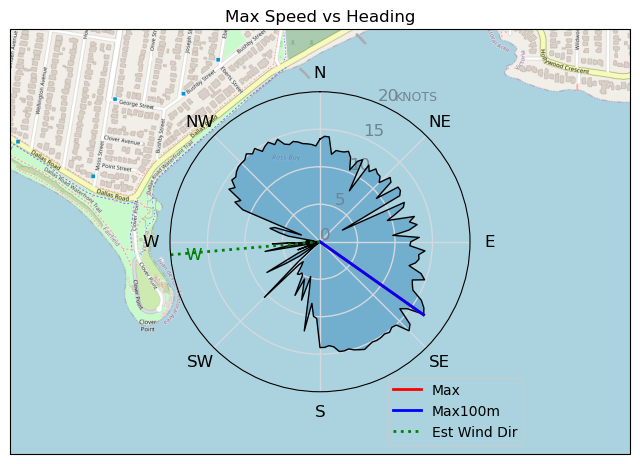
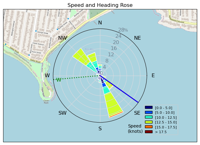
| Conditions | WSW 20-25, 1m-1.5m |
| TOW | 2.0 hours |
| Toys | 70 Armstrong Fuse |
| 865 Armstrong Mast | |
| 220 Armstrong Glide | |
| 880 Armstrong HA | |
| 4m Duotone Unit | |
| 99L Armstrong FG Wing SUP | |
| Details | Afternoon shift -- a bit of a wild session. Strong winds and good sized swell. A few months ago this would have been a survival mode session for me but today I felt mostly in control. Towards the end there was a crazy offshore wind shift, a total wind shut down, and then a little snow to top it all off. As we were packing up several police officers showed up at Goat Hill to coordinate with coast guard the rescue of a kiter that was stuck offshore (presumably when the wind shut off). As I left they had eyes on the kiter and the auxilliary CG RIB was speeding out towards them. I'm hoping that the kiter is ok, and I'm feeling very grateful to live in a place where we have people looking out for us! [from Session Log on Saturday February 01, 2025] |
Speed (3s average)
| Speed | knots | km/h |
|---|---|---|
| Avg overall | 4.5 | 8.3 |
| Avg in motion | 9.4 | 17.5 |
| Max | 16.9 | 31.3 |
| Max 100m | 16.0 | 29.7 |
| Max 250m | 14.6 | 27.1 |
| Max 500m | 14.4 | 26.7 |
| Max 2s | 16.8 | 31.2 |
| Max 10s | 16.3 | 30.1 |
| Max Alpha (500/50m) | 11.7 | 21.7 |
| Avg Foiling | 11.5 | 21.2 |
Times and Duration
| Start | Sat Feb 01, 1:37 PM |
| End | Sat Feb 01, 3:53 PM |
| Duration | 02:15:55 |
| In motion | 01:04:53 |
| Paused (< 3 km/h) | 01:10:59 |
| Foiling | 00:46:05 |
| Not Foiling (< 8 km/h) | 01:29:47 |
| Longest Foiling Segment | 00:02:26 (928 m) |
| Last Calculated | Sat Feb 01, 5:43 PM |
Track Information
| Distance | 18.9 km |
| # Trackpoints | 3622 |
| Avg Trackpoint distance | 5.2 m |
| Number of Turns | 24 |
| Foiling Turns (> 8 km/h) | 10 |
| Foiling Turn Percentage | 42% |


Category: Wingfoiling
4 hours ago

Created 4 hours ago
ThePope |
Please register/login to download this track.
This track was downloaded 0 time(s). |
| 23 February wild start |
| 23 CP - Bad Call Bobson |
| 30 Ross bay early morning session |
| 25 1/2/2025 |
| 31 Spit 01/31/25 |
Please wait while loading suggestions..
Please wait while loading suggestions..
You must login to post comments.