Harling Davidson
tweezer - Wingfoil |
Saturday May 07, 2022 10:44 AM |
| Spot | Ross Bay |
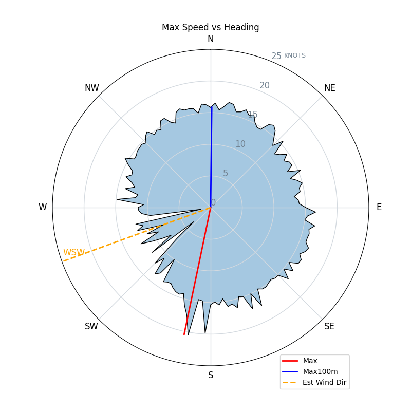
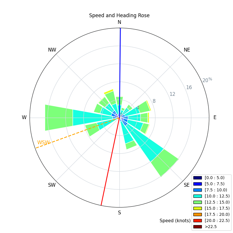
| Conditions | WSW 20-30, 1-chest |
| TOW | 3.0 hours |
| Toys | 1038cm2 Axis ART 999 |
| 68cm Axis short fuse | |
| 86cm Axis carbon mast v2 | |
| 420 (212cm2) Axis (mc) 420 speed rear | |
| 3.5 Takuma WK | |
| 5'4" 90L Quatro Wing Drifter | |
| Details | Saw RichardM on the water at RB and asked him how the swell was downwind. He said "Waaay better, come on down!" Downwinded to Harling pt. Checked out the wind buoy off the tip of trial but the best swell was in the channel. Spent a couple hours there and then the grind back upwind. Super fun! Might have to launch at Harling or McNeill next time! [from Sailing Log on Saturday May 07, 2022] |
Speed (3s average)
| Speed | knots | km/h |
|---|---|---|
| Avg overall | 9.5 | 17.6 |
| Avg in motion | 11.3 | 20.8 |
| Max | 20.5 | 37.9 |
| Max 100m | 15.9 | 29.4 |
| Max 250m | 15.3 | 28.4 |
| Max 500m | 14.0 | 26.0 |
| Max 1nm | 12.9 | 23.9 |
| Max 2s | 20.2 | 37.3 |
| Max 10s | 16.3 | 30.1 |
| Max 30min | 12.1 | 22.5 |
| Max 60min | 11.9 | 22.1 |
| Max Alpha (500/50m) | 13.3 | 24.6 |
| Avg Foiling | 11.4 | 21.2 |
Times and Duration
| Start | Sat May 07, 10:44 AM |
| End | Sat May 07, 1:36 PM |
| Duration | 02:52:18 |
| In motion | 02:25:10 |
| Paused (< 3 km/h) | 00:26:55 |
| Foiling | 02:20:06 |
| Not Foiling (< 6 km/h) | 00:31:59 |
| Last Calculated | Sun May 15, 1:49 PM |
Track Information
| Distance | 50.4 km |
| # Trackpoints | 8589 |
| Avg Trackpoint distance | 5.9 m |
| Number of Turns | 136 |
| Foiling Turns (> 6 km/h) | 102 |
| Foiling Turn Percentage | 75% |


Category: Wingfoiling
3 years ago

Created 3 years ago
tweezer |
Please register/login to download this track.
This track was downloaded 1 time(s). |
| 28 241120 Willows |
| 35 Willows Bomb Session |
| 37 Shoot the Entrance |
| 27 CloverPartDeux |
| 20 Come back soon Bombo |
Please wait while loading suggestions..
Please wait while loading suggestions..
You must login to post comments.