Dad Day RBFC
UnusuallyLargeRobin - Wingfoil |
Sunday June 19, 2022 4:26 PM |
| Spot | Ross Bay |
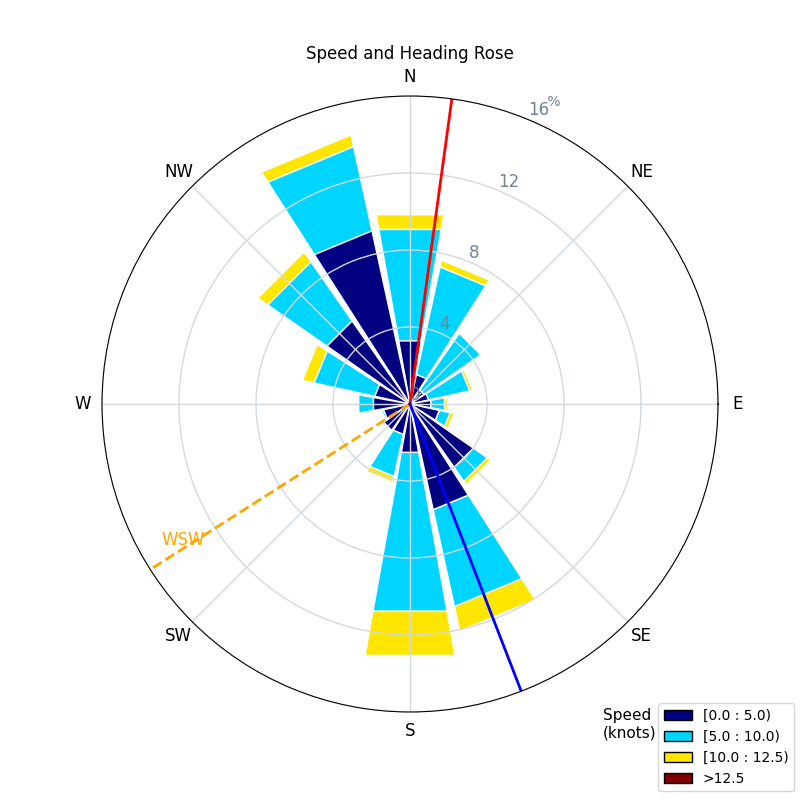
| Conditions | WSW 10-18, 2 footers |
| TOW | 1.5 hours |
| Toys | 187 lb / 85 kg Me Carbon-based Lifeform |
| PnG 1150 (1713cm2)/370 tail/Short fuse/90cm mast; Axis Foil | |
| 5.5 Duotone Unit | |
| 75 lt Fanatic Sky Wing 5'0 | |
| Details | Happy fathers day all! 4pm start, to join Tweezer, Brett, Tyler. Looked pretty light, but seemed doable even though Tweezer wasn't flying as i watched and he was outside the point! (that's not good). Was really tricky at first, so light and flood tide, with just enough wave action to make for tough starts. Eventually it began to fill in and all good, swell built and the downwind rides turned on! Beautiful sunny warm day, easy flying, cold apres beach beer. Cheers! [from Sailing Log on Sunday June 19, 2022] |
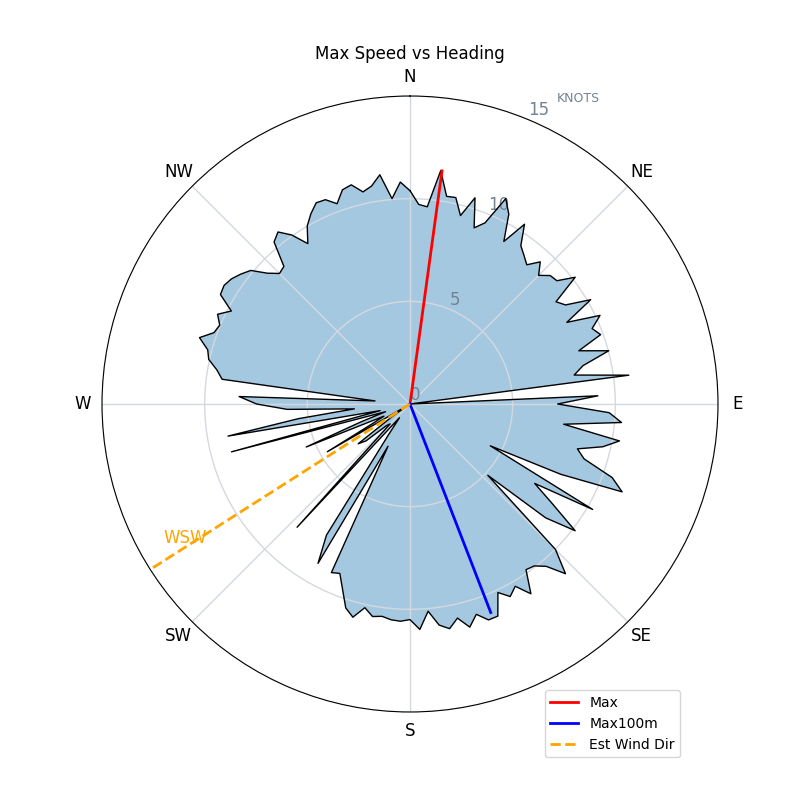
Speed (3s average)
| Speed | knots | km/h |
|---|---|---|
| Avg overall | 5.3 | 9.9 |
| Avg in motion | 7.0 | 13.0 |
| Max | 11.5 | 21.2 |
| Max 100m | 10.8 | 20.0 |
| Max 250m | 10.0 | 18.6 |
| Max 500m | 9.9 | 18.4 |
| Max 1nm | 8.2 | 15.2 |
| Max 2s | 11.5 | 21.2 |
| Max 10s | 11.0 | 20.4 |
| Max 30min | 6.9 | 12.9 |
| Max 60min | 5.9 | 10.9 |
| Max Alpha (500/50m) | 8.9 | 16.4 |
| Avg Foiling | 8.5 | 15.8 |
Times and Duration
| Start | Sun Jun 19, 4:26 PM |
| End | Sun Jun 19, 5:32 PM |
| Duration | 01:06:13 |
| In motion | 00:50:36 |
| Paused (< 3 km/h) | 00:15:04 |
| Foiling | 00:36:08 |
| Not Foiling (< 8 km/h) | 00:29:32 |
| Last Calculated | Mon Jun 20, 8:24 AM |
Track Information
| Distance | 10.9 km |
| # Trackpoints | 1922 |
| Avg Trackpoint distance | 5.7 m |
| Number of Turns | 46 |
| Foiling Turns (> 8 km/h) | 22 |
| Foiling Turn Percentage | 48% |


Category: Wingfoiling
2 years ago

Created 2 years ago
UnusuallyLargeRobin |
Please register/login to download this track.
This track was downloaded 0 time(s). |
| 29 241120 Willows |
| 37 Willows Bomb Session |
| 37 Shoot the Entrance |
| 27 CloverPartDeux |
| 21 Come back soon Bombo |
Please wait while loading suggestions..
Please wait while loading suggestions..
You must login to post comments.