RB16Sep22
UnusuallyLargeRobin - Wingfoil |
Friday September 16, 2022 1:23 PM |
| Spot | Ross Bay |
| Conditions | W 18-27, 2-4' footers |
| TOW | 2.5 hours |
| Toys | 187 lb / 85 kg Me Carbon-based Lifeform |
| PnG 1150 (1713cm2)/370 tail/Short fuse/90cm mast; Axis Foil | |
| 4.0 Duotone Unit | |
| 75 lt Fanatic Sky Wing 5'0 | |
| Details | Woohoo! That was a fun in the sun Friday free for all! Good crowd attending the "board meeting" after lunchtime. Some big speed and burns by a few peeps, loverly swell riding and the apres surf appertif to top it all off (thanks Tweez!) Dog, I'm glad that we could encourage and assist from our heckling roost, nothing like a cold beer and entertainment after a hard day. Cheers till next time! [from Sailing Log on Friday September 16, 2022] |
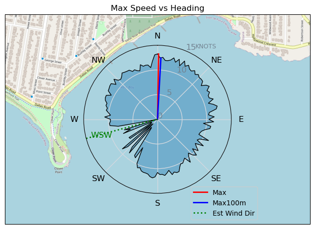
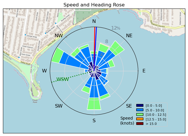
Speed (3s average)
| Speed | knots | km/h |
|---|---|---|
| Avg overall | 4.1 | 7.5 |
| Avg in motion | 8.9 | 16.4 |
| Max | 13.2 | 24.5 |
| Max 100m | 12.1 | 22.4 |
| Max 250m | 10.9 | 20.2 |
| Max 500m | 10.5 | 19.5 |
| Max 2s | 13.2 | 24.4 |
| Max 10s | 12.5 | 23.1 |
| Max 30min | 8.8 | 16.2 |
| Max Alpha (500/50m) | 9.8 | 18.1 |
| Avg Foiling | 9.1 | 16.9 |
Times and Duration
| Start | Fri Sep 16, 1:23 PM |
| End | Fri Sep 16, 5:25 PM |
| Duration | 04:02:14 |
| In motion | 01:51:02 |
| Paused (< 3 km/h) | 02:03:04 |
| Foiling | 01:42:55 |
| Not Foiling (< 8 km/h) | 02:11:11 |
| Last Calculated | Sat Sep 17, 1:54 PM |
Track Information
| Distance | 30.4 km |
| # Trackpoints | 4699 |
| Avg Trackpoint distance | 6.5 m |
| Number of Turns | 159 |
| Foiling Turns (> 8 km/h) | 98 |
| Foiling Turn Percentage | 62% |


Category: Wingfoiling
2 years ago

Created 2 years ago
UnusuallyLargeRobin |
Please register/login to download this track.
This track was downloaded 0 time(s). |
| 29 241120 Willows |
| 37 Willows Bomb Session |
| 38 Shoot the Entrance |
| 28 CloverPartDeux |
| 22 Come back soon Bombo |
Please wait while loading suggestions..
Please wait while loading suggestions..
You must login to post comments.