Big Turkey Shoot
UnusuallyLargeRobin - Wingfoil |
Monday October 10, 2022 12:44 PM |
| Spot | Ross Bay |
| Conditions | W 18-30, 3-5' swell |
| TOW | 2.5 hours |
| Toys | 1150/425p/crazyshort/90mast Axis Foil |
| 187 lb / 85 kg Me Carbon-based Lifeform | |
| S25 3.6m Naish Wingsurfer | |
| 75 lt Fanatic Sky Wing 5'0 | |
| Details | Big wind! Big waves! Big crowd of wings (20ish)! With a sprinkle or 2 of windfoilers. Happy Turkey Day all. 12:30 start, rigged the 5.5m and lasted 2 reaches before scampering back to the beach for the 3.6m. That made things much more comfortable, but it was still hairy with all the crap in the water everywhere. Hardly any reaches without a kelp, wood, or eelgrass induced dismount, and that on top of my rusty nuking skills. When was the last blow with waves like that? Took the predicted 2pm lull break, then got sucked into rigging the 5.5m again, and again lasted 2 reaches before scampering back to the beach for the 3.6m. More of the same, big wave drop-ins and flag rides usually ending in surprise kelp attacks. Still a lot of fun and lots of grins on faces. [from Sailing Log on Monday October 10, 2022] |
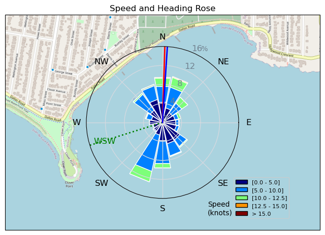
Speed (3s average)
| Speed | knots | km/h |
|---|---|---|
| Avg overall | 3.2 | 6.0 |
| Avg in motion | 7.7 | 14.3 |
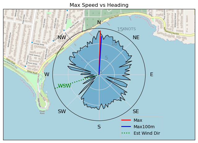
| Max | 14.2 | 26.2 |
| Max 100m | 12.8 | 23.6 |
| Max 250m | 11.0 | 20.3 |
| Max 500m | 10.3 | 19.1 |
| Max 2s | 14.1 | 26.1 |
| Max 10s | 13.2 | 24.4 |
| Max Alpha (500/50m) | 9.4 | 17.3 |
| Avg Foiling | 8.9 | 16.4 |
Times and Duration
| Start | Mon Oct 10, 12:44 PM |
| End | Mon Oct 10, 4:10 PM |
| Duration | 03:25:53 |
| In motion | 01:25:46 |
| Paused (< 3 km/h) | 01:55:31 |
| Foiling | 01:05:20 |
| Not Foiling (< 8 km/h) | 02:15:57 |
| Last Calculated | Tue Oct 11, 10:28 AM |
Track Information
| Distance | 20.5 km |
| # Trackpoints | 4183 |
| Avg Trackpoint distance | 4.9 m |
| Number of Turns | 96 |
| Foiling Turns (> 8 km/h) | 21 |
| Foiling Turn Percentage | 22% |


Category: Wingfoiling
2 years ago

Created 2 years ago
UnusuallyLargeRobin |
Please register/login to download this track.
This track was downloaded 0 time(s). |
| 32 241120 Willows |
| 39 Willows Bomb Session |
| 38 Shoot the Entrance |
| 29 CloverPartDeux |
| 23 Come back soon Bombo |
Please wait while loading suggestions..
Please wait while loading suggestions..
You must login to post comments.