Grazing Cattle
UnusuallyLargeRobin - Wingfoil |
Sunday October 16, 2022 12:28 PM |
| Spot | Cattle Pt |
| Conditions | C 12-15, flattish |
| TOW | 1.3 hours |
| Toys | 187 lb / 85 kg Me Carbon-based Lifeform |
| PnG1150(1713cm2)/370 tail/CrazyShort/90cm mast Axis Foil | |
| 5.5 Duotone Unit | |
| 75 lt Fanatic Sky Wing 5'0 | |
| Details | Beautiful sunny warm day with flying wind! Way better than forecast and did i mention warm!! Got to play in amongst the large groups of sailboats. Was always polite and gave way with lots of room, never challenged them even though i was on starboard many times. A good crowd of wingers - windjunky, Paul, John, Gus, BangaGongMark, Windoc, and late to the party but with his correct wing this time Tweezer. Such a nice day! Maybe the best day evah Bobson! [from Sailing Log on Sunday October 16, 2022] |
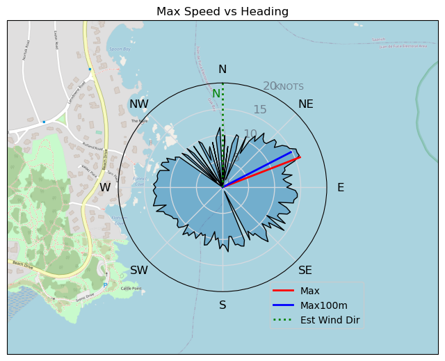
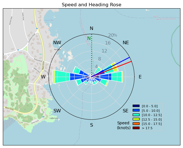
Speed (3s average)
| Speed | knots | km/h |
|---|---|---|
| Avg overall | 6.4 | 11.9 |
| Avg in motion | 9.6 | 17.8 |
| Max | 15.9 | 29.5 |
| Max 100m | 15.3 | 28.3 |
| Max 250m | 14.3 | 26.6 |
| Max 500m | 12.6 | 23.3 |
| Max 2s | 15.9 | 29.5 |
| Max 10s | 15.4 | 28.5 |
| Max Alpha (500/50m) | 10.7 | 19.8 |
| Avg Foiling | 10.0 | 18.6 |
Times and Duration
| Start | Sun Oct 16, 12:28 PM |
| End | Sun Oct 16, 1:45 PM |
| Duration | 01:16:34 |
| In motion | 00:51:09 |
| Paused (< 3 km/h) | 00:24:52 |
| Foiling | 00:45:46 |
| Not Foiling (< 8 km/h) | 00:30:15 |
| Last Calculated | Sun Oct 16, 4:15 PM |
Track Information
| Distance | 15.2 km |
| # Trackpoints | 1818 |
| Avg Trackpoint distance | 8.3 m |
| Number of Turns | 77 |
| Foiling Turns (> 8 km/h) | 63 |
| Foiling Turn Percentage | 82% |


Category: Wingfoiling
2 years ago

Created 2 years ago
UnusuallyLargeRobin |
Please register/login to download this track.
This track was downloaded 0 time(s). |
| 32 241120 Willows |
| 39 Willows Bomb Session |
| 38 Shoot the Entrance |
| 29 CloverPartDeux |
| 23 Come back soon Bombo |
Please wait while loading suggestions..
Please wait while loading suggestions..
You must login to post comments.