Wing Quartet
UnusuallyLargeRobin - Wingfoil |
Thursday October 20, 2022 5:41 PM |
| Spot | Ross Bay |
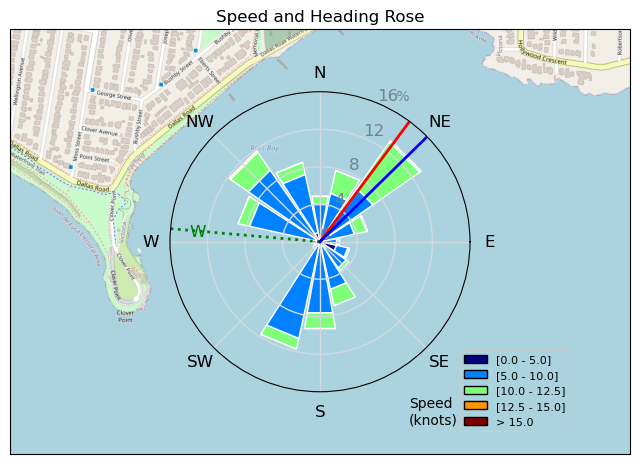
| Conditions | WSW 15-19, 1-2' |
| TOW | 1.0 hours |
| Toys | 1150/425p/crazyshort/90mast Axis Foil |
| 187 lb / 85 kg Me Carbon-based Lifeform | |
| 5.5 Duotone Unit | |
| 75 lt Fanatic Sky Wing 5'0 | |
| Details | Decided to check out Ross as it seemed windy at my house, and the cam looked promising. Arrived about 5:30 and GongMark was rigged and about to go out with DrMark following closely behind. The boys were quickly flying and it was definitely happening on the outside. It was really nice, solid 17kn, clean, no kelp or wood, with some nice swell building. Brett showed up a little later to complete our wing quartet. I think this may be the first session I've stayed dry with no falls, bails, or flotsam dismounts! [from Sailing Log on Thursday October 20, 2022] |
Speed (3s average)
| Speed | knots | km/h |
|---|---|---|
| Avg overall | 8.3 | 15.5 |
| Avg in motion | 9.0 | 16.6 |
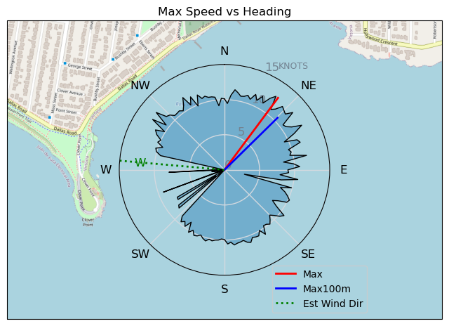
| Max | 12.8 | 23.7 |
| Max 100m | 11.2 | 20.7 |
| Max 250m | 10.5 | 19.4 |
| Max 500m | 10.0 | 18.6 |
| Max 2s | 12.7 | 23.6 |
| Max 10s | 12.2 | 22.6 |
| Max Alpha (500/50m) | 9.9 | 18.3 |
| Avg Foiling | 9.2 | 17.0 |
Times and Duration
| Start | Thu Oct 20, 5:41 PM |
| End | Thu Oct 20, 6:21 PM |
| Duration | 00:39:53 |
| In motion | 00:37:09 |
| Paused (< 3 km/h) | 00:02:35 |
| Foiling | 00:35:33 |
| Not Foiling (< 8 km/h) | 00:04:11 |
| Last Calculated | Thu Oct 20, 9:01 PM |
Track Information
| Distance | 10.3 km |
| # Trackpoints | 1118 |
| Avg Trackpoint distance | 9.2 m |
| Number of Turns | 46 |
| Foiling Turns (> 8 km/h) | 43 |
| Foiling Turn Percentage | 93% |


Category: Wingfoiling
2 years ago

Created 2 years ago
UnusuallyLargeRobin |
Please register/login to download this track.
This track was downloaded 0 time(s). |
| 32 241120 Willows |
| 39 Willows Bomb Session |
| 38 Shoot the Entrance |
| 29 CloverPartDeux |
| 23 Come back soon Bombo |
Please wait while loading suggestions..
Please wait while loading suggestions..
You must login to post comments.