WhoLetTheDogsOut
UnusuallyLargeRobin - Wingfoil |
Friday November 04, 2022 2:19 PM |
| Spot | Ross Bay |
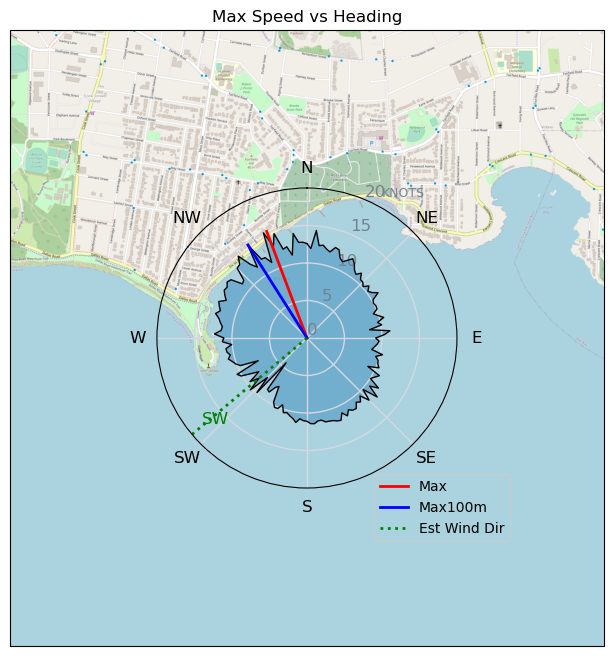
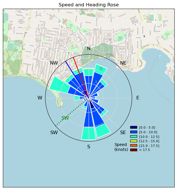
| Conditions | SW 10-17, 1-3' |
| TOW | 3.0 hours |
| Toys | 1150/425p/crazyshort/90mast Axis Foil |
| 5.5 Duotone Unit | |
| 75 lt Fanatic Sky Wing 5'0 | |
| Details | Friday fun! It's the weekend and wind, wind, and more wind (hopefully). A nice easy wing session, not quite as windy as advertised. I guess the "severe weather, stay off beach access" sign the city put up pretty much killed that idea. Me thinks people are getting a little too obsessed with instilling fear at every chance..nuff said. Anyway, was good fun all around, lots of wingers 16+, notable absentees (bwd, shaggy, windoc, bobson) almost like they knew some secret spot' Tweezer and I buzzed around Gus&Mark while they raft bobbed around together by Clover. Looked like some sort of tea party or drug deal going down at sea as they sat under their wings. A little bit of a lull and then it picked up for the finish in the gloaming. [from Sailing Log on Friday November 04, 2022] |
Speed (3s average)
| Speed | knots | km/h |
|---|---|---|
| Avg overall | 6.7 | 12.3 |
| Avg in motion | 9.5 | 17.6 |
| Max | 15.2 | 28.1 |
| Max 100m | 12.6 | 23.3 |
| Max 250m | 11.4 | 21.2 |
| Max 500m | 10.7 | 19.8 |
| Max 2s | 14.9 | 27.7 |
| Max 10s | 13.6 | 25.2 |
| Max Alpha (500/50m) | 10.3 | 19.0 |
| Avg Foiling | 9.2 | 17.0 |
Times and Duration
| Start | Fri Nov 04, 2:19 PM |
| End | Fri Nov 04, 5:16 PM |
| Duration | 02:56:57 |
| In motion | 02:04:16 |
| Paused (< 3 km/h) | 00:52:23 |
| Foiling | 01:52:27 |
| Not Foiling (< 8 km/h) | 01:04:12 |
| Last Calculated | Sat Nov 05, 9:52 AM |
Track Information
| Distance | 36.4 km |
| # Trackpoints | 4675 |
| Avg Trackpoint distance | 7.8 m |
| Number of Turns | 154 |
| Foiling Turns (> 8 km/h) | 126 |
| Foiling Turn Percentage | 82% |


Category: Wingfoiling
2 years ago

Created 2 years ago
UnusuallyLargeRobin |
Please register/login to download this track.
This track was downloaded 0 time(s). |
| 32 241120 Willows |
| 39 Willows Bomb Session |
| 38 Shoot the Entrance |
| 29 CloverPartDeux |
| 23 Come back soon Bombo |
Please wait while loading suggestions..
Please wait while loading suggestions..
You must login to post comments.