Clover 2023-06-30
davey_k - Kitesurfing |
Friday June 30, 2023 5:02 PM |
| Spot | Clover Pt |
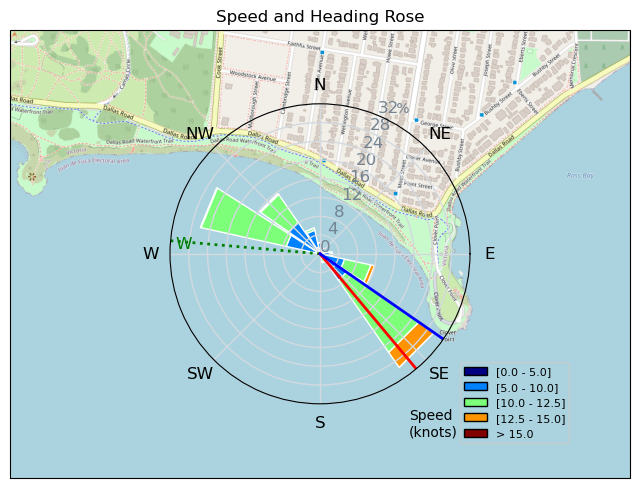
| Conditions | WSW 18-24, flood tide chop |
| TOW | 1.0 hours |
| Toys | 52cm Ocean Rodeo Shift Bar (Gen 3) |
| 12 Ocean Rodeo Crave HL | |
| 5'10" Slingshot Celero FR | |
| Details | Pumped the 10m and self launched only to have a shore bubble form. I was standing there on Clover point with a kite in the air but no power in the kite at all. I landed the kite and put it away. After a half hour, the wind came back modestly and so I pumped a 12m. I self launched as the wind became more like 10m wind. I decided to go out on the 12m and had most of the depower on for the whole session. Near the end of the session the wind backed off somewhat so coming ashore was not an issue. Tide was flooding and the water was choppy but still had loads of fun. [from Sailing Log on Friday June 30, 2023] |
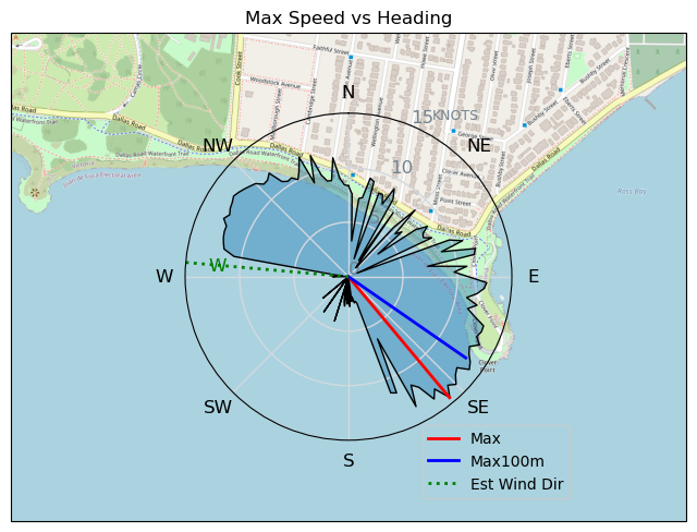
Speed (3s average)
| Speed | knots | km/h |
|---|---|---|
| Avg overall | 7.8 | 14.4 |
| Avg in motion | 9.3 | 17.3 |
| Max | 14.5 | 26.8 |
| Max 100m | 13.1 | 24.2 |
| Max 250m | 12.4 | 22.9 |
| Max 500m | 11.8 | 21.8 |
| Max 2s | 14.4 | 26.6 |
| Max 10s | 13.2 | 24.5 |
| Max Alpha (500/50m) | 11.1 | 20.6 |
| Avg Planing | 10.2 | 18.8 |
Times and Duration
| Start | Fri Jun 30, 5:02 PM |
| End | Fri Jun 30, 6:01 PM |
| Duration | 00:59:05 |
| In motion | 00:49:17 |
| Paused (< 3 km/h) | 00:09:46 |
| Planing | 00:42:41 |
| Not Planing (< 8 km/h) | 00:16:22 |
| Last Calculated | Sat Jul 01, 10:40 AM |
Track Information
| Distance | 14.2 km |
| # Trackpoints | 2834 |
| Avg Trackpoint distance | 5.0 m |
| Number of Turns | 30 |
| Planing Turns (> 8 km/h) | 18 |
| Planing Turn Percentage | 60% |


Category: Kitesurfing
one year ago

Created one year ago
davey_k |
Please register/login to download this track.
This track was downloaded 0 time(s). |
| 70 241124 Willows |
| 71 WillowsQuickie |
| 62 Willows - Sunday Funday Woops |
| 59 Willows Mixed Bag |
| 50 Surprise Sunday ENE. |
Please wait while loading suggestions..
Please wait while loading suggestions..
You must login to post comments.