Clover sunset session 10Jul23
j_dog - Kitefoiling |
Monday July 10, 2023 7:30 PM |
| Spot | Clover Pt |
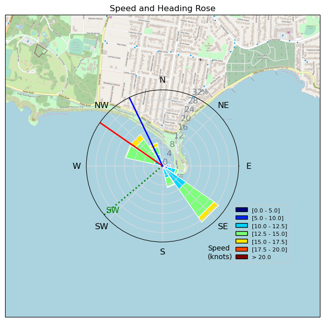
| Conditions | SSW 17-23, choppy, swell |
| TOW | 1.0 hours |
| Toys | 7m AIRUSH WAVE |
| 110cm Liquid Force Nubile Board 3'8" 13 lts | |
| 1250cm Slingshot Phantasm 633 Foil | |
| 92cm Slingshot Phantasm Mast | |
| Details | First session after nitinaht and I rigged bigger as a precaution, so rigged the 7m and foil. Was a little overpowered at the start but as the wind went down, I was in the sweet spot by the end of the session. Spend the first half of the session on the Ross Bay side then headed up at Cook, managed to hit a few random kelp that resulted in some decent faceplants. Good to see Aldo up on his surfboard. Overall a nice sunset session, need to remember sunglasses next time. [from Sailing Log on Monday July 10, 2023] |
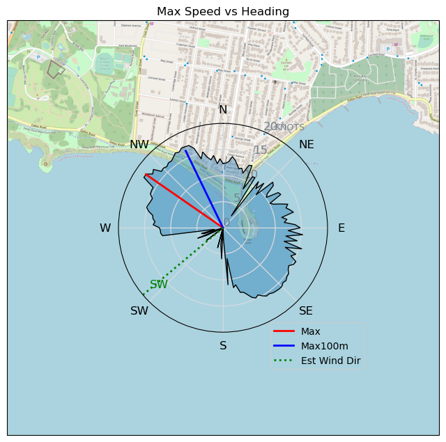
Speed (3s average)
| Speed | knots | km/h |
|---|---|---|
| Avg overall | 11.0 | 20.4 |
| Avg in motion | 11.8 | 21.8 |
| Max | 18.0 | 33.2 |
| Max 100m | 16.8 | 31.0 |
| Max 250m | 16.6 | 30.7 |
| Max 500m | 15.7 | 29.0 |
| Max 2s | 17.9 | 33.2 |
| Max 10s | 16.8 | 31.2 |
| Max Alpha (500/50m) | 14.4 | 26.7 |
| Avg Foiling | 12.6 | 23.3 |
Times and Duration
| Start | Mon Jul 10, 7:30 PM |
| End | Mon Jul 10, 8:39 PM |
| Duration | 01:09:11 |
| In motion | 01:04:45 |
| Paused (< 3 km/h) | 00:04:22 |
| Foiling | 00:59:00 |
| Not Foiling (< 8 km/h) | 00:10:07 |
| Last Calculated | Mon Jul 10, 10:32 PM |
Track Information
| Distance | 23.5 km |
| # Trackpoints | 3729 |
| Avg Trackpoint distance | 6.3 m |
| Number of Turns | 67 |
| Foiling Turns (> 8 km/h) | 56 |
| Foiling Turn Percentage | 84% |


Category: Kitefoiling
one year ago

Created one year ago
j_dog |
Please register/login to download this track.
This track was downloaded 0 time(s). |
| 65 241124 Willows |
| 65 WillowsQuickie |
| 57 Willows - Sunday Funday Woops |
| 54 Willows Mixed Bag |
| 48 Surprise Sunday ENE. |
Please wait while loading suggestions..
Please wait while loading suggestions..
You must login to post comments.