surprise surprise…. Surprise SURPRISE!
AJSpencer - Wingfoiling |
Saturday November 04, 2023 12:45 PM |
| Spot | Pat Bay |
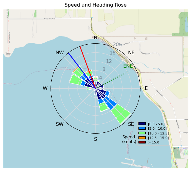
| Conditions | SW 15-35, big and small |
| TOW | 1.5 hours |
| Toys | 105 Axis Mast |
| 1010 Axis PNG | |
| 4.0 Duotone Slick | |
| 105 Quatro Wing Drifter | |
| Details | Whewie. Forecasted for 15ish but blew up out here. Seemed 25ish when I arrived so watched for a bit, assuming 5m conditions. But it was steady so went with 4m. Turned out to be 3m conditions, fully flagged out and over-foiled as well. Refused to go in to rig dow. when its forecasted lighter and at Pat Bay but should have to really get the most out of that nice steady and powerful wind. South and steady enough to get the beginning of nice rollers a little further out on the North shore. But eventually died and came back indecisively between SW and W. Porpoises in the bay again. [from Session Log on Saturday November 04, 2023] |
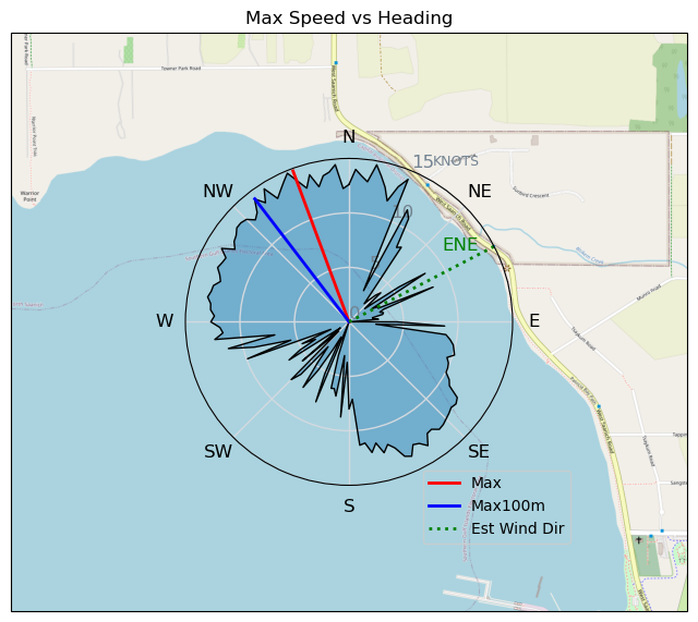
Speed (3s average)
| Speed | knots | km/h |
|---|---|---|
| Avg overall | 4.5 | 8.4 |
| Avg in motion | 7.6 | 14.1 |
| Max | 14.8 | 27.4 |
| Max 100m | 13.8 | 25.5 |
| Max 250m | 12.7 | 23.6 |
| Max 500m | 11.9 | 22.1 |
| Max 2s | 14.7 | 27.2 |
| Max 10s | 14.0 | 26.0 |
| Max Alpha (500/50m) | 8.9 | 16.4 |
| Avg Foiling | 10.2 | 18.9 |
Times and Duration
| Start | Sat Nov 04, 12:45 PM |
| End | Sat Nov 04, 2:30 PM |
| Duration | 01:44:26 |
| In motion | 01:02:14 |
| Paused (< 3 km/h) | 00:41:21 |
| Foiling | 00:38:39 |
| Not Foiling (< 8 km/h) | 01:04:56 |
| Longest Foiling Segment | 00:04:14 (1.4 km) |
| Last Calculated | Sat Nov 04, 3:08 PM |
Track Information
| Distance | 14.7 km |
| # Trackpoints | 5166 |
| Avg Trackpoint distance | 2.8 m |
| Number of Turns | 45 |
| Foiling Turns (> 8 km/h) | 0 |
| Foiling Turn Percentage | 0% |


Category: Wingfoiling
one year ago

Created one year ago
AJSpencer |
Please register/login to download this track.
This track was downloaded 0 time(s). |
| 37 241124 Willows |
| 40 WillowsQuickie |
| 37 Willows - Sunday Funday Woops |
| 38 Willows Mixed Bag |
| 28 Surprise Sunday ENE. |
Please wait while loading suggestions..
Please wait while loading suggestions..
You must login to post comments.