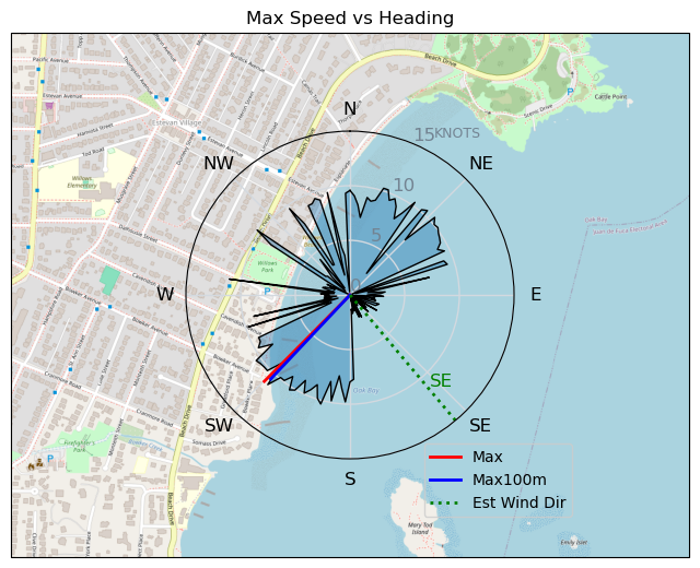
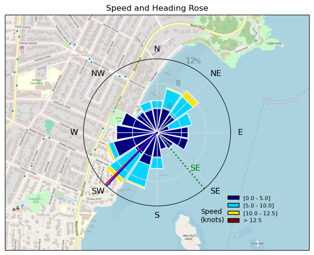
240131 Willows Beach
Highrocker - Wingfoiling |
Wednesday January 31, 2024 12:19 PM |
| Spot | Willows Bch |
| Conditions | SE 2-20, Mostly flat |
| TOW | 0.5 hours |
| Toys | 900mm Axis Aluminum Mast |
| 2050sqcm Axis 1020mm Carbon Front Wing | |
| 6.2m Cabrinha Mantis | |
| 115L JP Australia Foil Pro | |
| Details | I was intimidated by the morning winds and I didn't have Cloverfield level skills to play in that venue. So, I jumped at the chance to hit Willows at noon as the winds reduced. It felt like 5 or 6m when I got there and then degraded forcing me onto my 6.2m. I quickly got up on foil and did sine wave jibes and then a few quick runs from MTI to CP. I came in to meet Idefix just coming out and the winds just ended. I ended up using my emerg paddle and stroking in from mid-bay to beach. I tried CP with Bobson, but no. Bah! [from Session Log on Wednesday January 31, 2024] |
Speed (3s average)
| Speed | knots | km/h |
|---|---|---|
| Avg overall | 2.9 | 5.4 |
| Avg in motion | 7.1 | 13.1 |
| Max | 11.1 | 20.6 |
| Max 100m | 10.6 | 19.5 |
| Max 250m | 9.9 | 18.3 |
| Max 500m | 9.6 | 17.7 |
| Max 2s | 11.1 | 20.6 |
| Max 10s | 10.9 | 20.3 |
| Max Alpha (500/50m) | 8.6 | 15.9 |
| Avg Foiling | 8.5 | 15.7 |
Times and Duration
| Start | Wed Jan 31, 12:19 PM |
| End | Wed Jan 31, 1:17 PM |
| Duration | 00:57:49 |
| In motion | 00:23:49 |
| Paused (< 3 km/h) | 00:32:36 |
| Foiling | 00:15:49 |
| Not Foiling (< 8 km/h) | 00:40:36 |
| Longest Foiling Segment | 00:06:29 (1.7 km) |
| Last Calculated | Wed Jan 31, 7:21 PM |
Track Information
| Distance | 5.2 km |
| # Trackpoints | 839 |
| Avg Trackpoint distance | 6.2 m |
| Number of Turns | 23 |
| Foiling Turns (> 8 km/h) | 7 |
| Foiling Turn Percentage | 30% |


Category: Wingfoiling
10 months ago

Created 10 months ago
Highrocker |
Please register/login to download this track.
This track was downloaded 0 time(s). |
Please wait while loading suggestions..
Please wait while loading suggestions..
You must login to post comments.