Satellite Channel Feb 14
AJSpencer - Wingfoiling |
Wednesday February 14, 2024 11:35 AM |
| Spot | [Secret spot] |
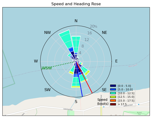
| Conditions | ENE 15-25, decent |
| TOW | 1.0 hours |
| Toys | 400 Axis Rear Performance |
| 300 Axis Rear Performance | |
| 999 Axis Art | |
| 105 Axis Mast | |
| 1010 Axis PNG | |
| 4.0 Duotone Slick | |
| 105 Quatro Wing Drifter | |
| Details | Been wanting to try this spot. A ways East of Moses Pt, I call it Whale Rock. Off Landsend in Satellite Channel. Immediately regretted having the 999 setup on as the wind was a bit marginal for the 4m, so came in and painstakingly extracted those long ass bolts and swapped in to 1010. Then it was great. Swung by a nice cruising sloop at full sail in 20 knots powering up the Channel to say hi. Occasional short rides on decent waves. Looking forward to more of this spot in the future. Bit of a hike though. [from Session Log on Wednesday February 14, 2024] |
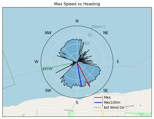
Speed (3s average)
| Speed | knots | km/h |
|---|---|---|
| Avg overall | 6.2 | 11.5 |
| Avg in motion | 8.6 | 15.9 |
| Max | 15.5 | 28.7 |
| Max 100m | 13.8 | 25.5 |
| Max 250m | 13.1 | 24.2 |
| Max 500m | 12.9 | 23.8 |
| Max 2s | 15.3 | 28.3 |
| Max 10s | 13.9 | 25.7 |
| Max Alpha (500/50m) | 9.4 | 17.5 |
| Avg Foiling | 10.8 | 19.9 |
Times and Duration
| Start | Wed Feb 14, 11:35 AM |
| End | Wed Feb 14, 12:39 PM |
| Duration | 01:04:21 |
| In motion | 00:46:26 |
| Paused (< 3 km/h) | 00:16:31 |
| Foiling | 00:32:35 |
| Not Foiling (< 8 km/h) | 00:30:22 |
| Longest Foiling Segment | 00:03:15 (1.1 km) |
| Last Calculated | Wed Feb 14, 1:42 PM |
Track Information
| Distance | 12.3 km |
| # Trackpoints | 3632 |
| Avg Trackpoint distance | 3.4 m |
| Number of Turns | 40 |
| Foiling Turns (> 8 km/h) | 0 |
| Foiling Turn Percentage | 0% |


Category: Wingfoiling
10 months ago

Created 10 months ago
AJSpencer |
Please register/login to download this track.
This track was downloaded 0 time(s). |
| 34 241124 Willows |
| 37 WillowsQuickie |
| 33 Willows - Sunday Funday Woops |
| 30 Willows Mixed Bag |
| 25 Surprise Sunday ENE. |
Please wait while loading suggestions..
Please wait while loading suggestions..
You must login to post comments.