White Rock East Beach
Tsawwassen - Wingfoiling |
Sunday February 25, 2024 1:14 PM |
| Spot | [Secret spot] |
| Conditions | SSW 20-30, Shoulder High |
| TOW | 2.0 hours |
| Toys | Sabfoil 370 Stab |
| 1050 cm sq Sabfoil W730 | |
| 93cm Sabfoil Kraken Mast | |
| 703 mm Sabfoil Kraken Fuse F703K | |
| 3.5 KT Wing Air | |
| 72 KT Wing Drifter | |
| Details | Double session today! Fun but challenging day. First time winging at White Rock, some good and some bad points. It was tough getting through the break when the tide was low. Once outside though there were some nice steep waves to ride, sometimes a little too steep. :o Caught some nice topside rides though once I got used to things. When the wind switched it was too much for my 3.5 wing so I came in and switched to windsurfing. Unfortunately it had started to drop by the time I got out. Still got a few nice reaches in and a few good wave rides. [from Session Log on Sunday February 25, 2024] |
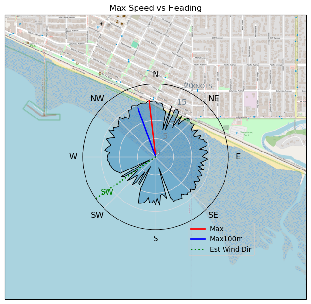
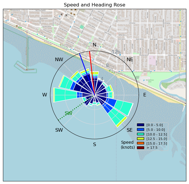
Speed (3s average)
| Speed | knots | km/h |
|---|---|---|
| Avg overall | 5.1 | 9.4 |
| Avg in motion | 8.2 | 15.1 |
| Max | 15.5 | 28.7 |
| Max 100m | 14.3 | 26.4 |
| Max 250m | 13.3 | 24.6 |
| Max 500m | 12.3 | 22.7 |
| Max 2s | 15.3 | 28.3 |
| Max 10s | 14.5 | 26.9 |
| Max Alpha (500/50m) | 11.6 | 21.6 |
| Avg Foiling | 10.4 | 19.2 |
Times and Duration
| Start | Sun Feb 25, 1:14 PM |
| End | Sun Feb 25, 3:23 PM |
| Duration | 02:09:01 |
| In motion | 01:20:18 |
| Paused (< 3 km/h) | 00:39:12 |
| Foiling | 00:52:59 |
| Not Foiling (< 8 km/h) | 01:06:31 |
| Longest Foiling Segment | 00:04:59 (1.5 km) |
| Last Calculated | Sun Feb 25, 10:20 PM |
Track Information
| Distance | 20.3 km |
| # Trackpoints | 7437 |
| Avg Trackpoint distance | 2.7 m |
| Number of Turns | 89 |
| Foiling Turns (> 8 km/h) | 16 |
| Foiling Turn Percentage | 18% |


Category: Wingfoiling
9 months ago

Created 9 months ago
Tsawwassen |
Please register/login to download this track.
This track was downloaded 0 time(s). |
| 34 241124 Willows |
| 37 WillowsQuickie |
| 33 Willows - Sunday Funday Woops |
| 30 Willows Mixed Bag |
| 25 Surprise Sunday ENE. |
Please wait while loading suggestions..
Please wait while loading suggestions..
You must login to post comments.